History of Rowville and Wellington Village
In celebration of the 20th Birthday of Wellington Village we have put together a brief history of the site and the Rowville area which we hope you will find interesting and informative.
PRE-COLONIAL SETTLEMENT
Before European settlement, the land around Rowville was inhabited by the Wurundjeri and Bunurong people of the Kulin Nation (40,000 years BP). This area was a significant meeting place, rich with natural resources, supporting a diverse ecosystem. Indigenous people used the land for hunting, gathering, and conducting ceremonial activities, leaving behind a legacy of cultural and spiritual significance.
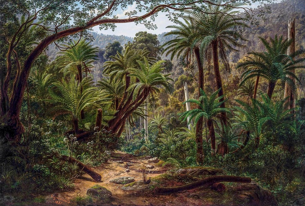
Painting by Von Guerard, Ferntree Gully in Dandenong Ranges 1857.
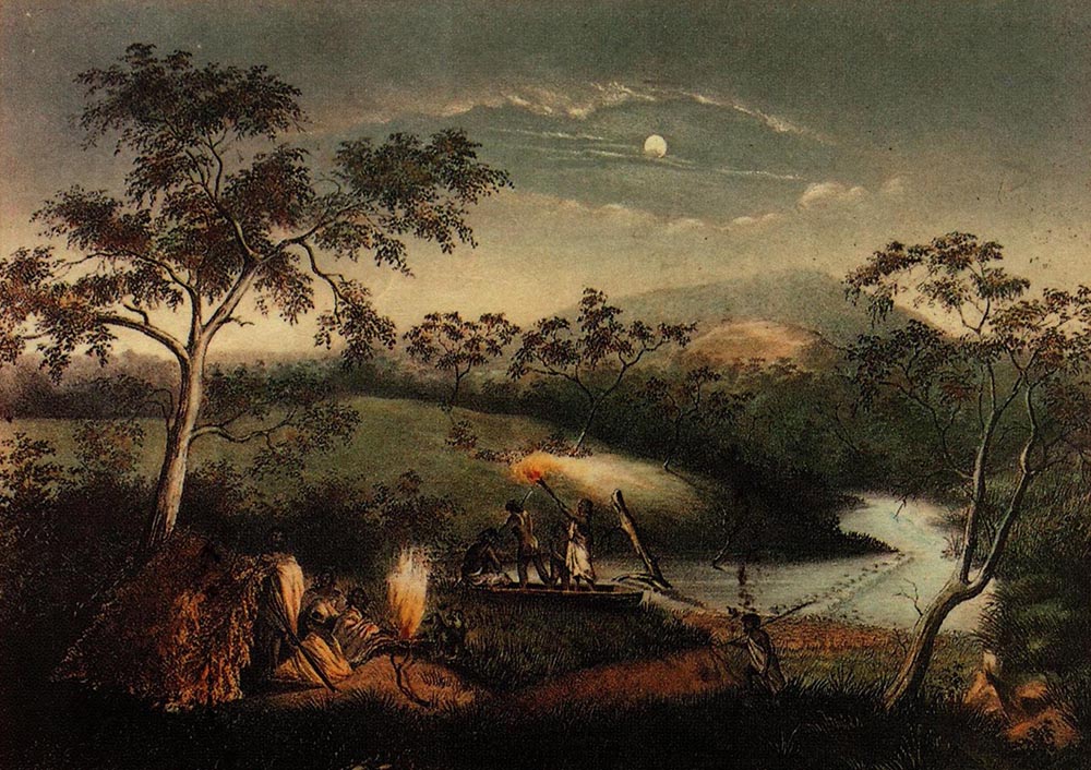
Woiwurrung People on the Merri Creek by Charles Troedel Created: 31 December 1864.
Image of the painting sourced from Wikipedia: https://en.wikipedia.org/wiki/Woiwurrung. Takver (user:tirin). Original artwork by Charles Troedel, 1864 – Souvenir Views of Melbourne and Victorian Scenery, Melbourne, 1865. Held in the La Trobe Collection, State Library of Victoria. Now in Public Domain.
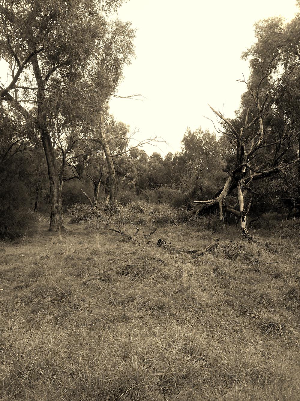
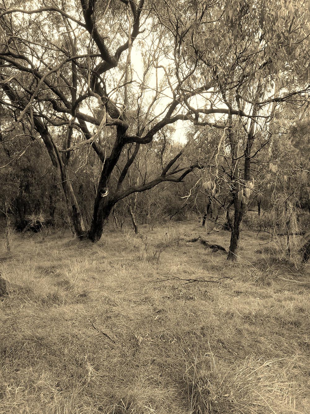
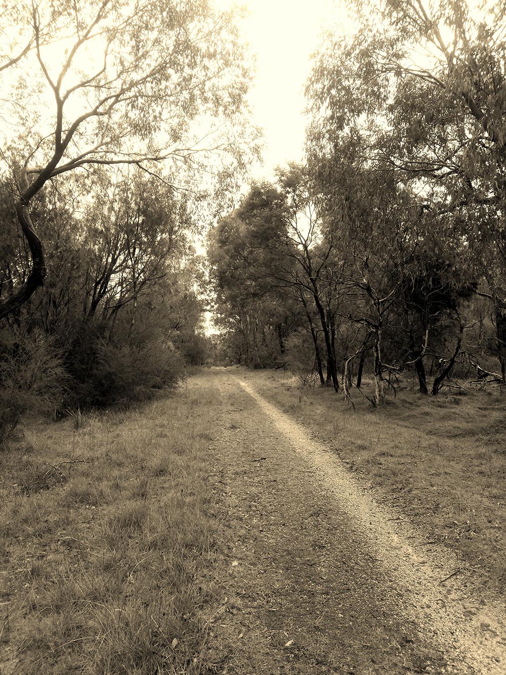
The photos below are typical of the likely vegetation pre European and early post European settlement of the Rowville area and we believe that the location of Wellington Village would have looked very similar.
Traditional Custodians
Wurundjeri and Bunurong People: The traditional custodians of the land where Rowville and Wellington Village are located are the Wurundjeri and Bunurong people of the Kulin Nation. These groups have a deep cultural and spiritual connection to the land, dating back thousands of years.
Meeting Place: The area was a significant meeting place for the Wurundjeri and Bunurong people, who engaged in various cultural, social, and economic activities. Dandenong Creek was a vital source of food and water, with the landscape featuring stone artefacts and scarred trees.
ROWVILLE THROUGH THE AGES
Discover the rich history of Rowville, from its Indigenous roots through to European settlement, agricultural endeavours, wartime significance, housing and community developments and its vibrant present. This timeline will guide you through the key eras that have shaped the Rowville community as it is today.
ROWVILLE’S AGRICULTURAL HERITAGE
The Rowville we see today is vastly different from the predominantly agricultural landscape of the early 1900’s where land was divided and sold into smaller farm lots. In those days it was all hands on deck with many children helping on the farms up into their adulthood, milking and raising crops and livestock through the challenging times of the wars and depression. Their efforts laid the foundations for the vibrant community we know today. The names of some of these early farming families were Taylor, Raymond, Kellett, Dobson, Finn and Gearon.
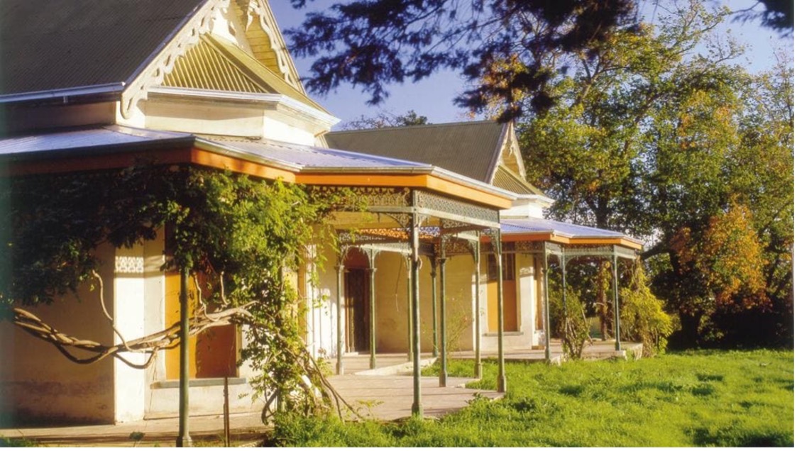
Stamford Park Homestead, 2 Emmeline Row, Rowville.
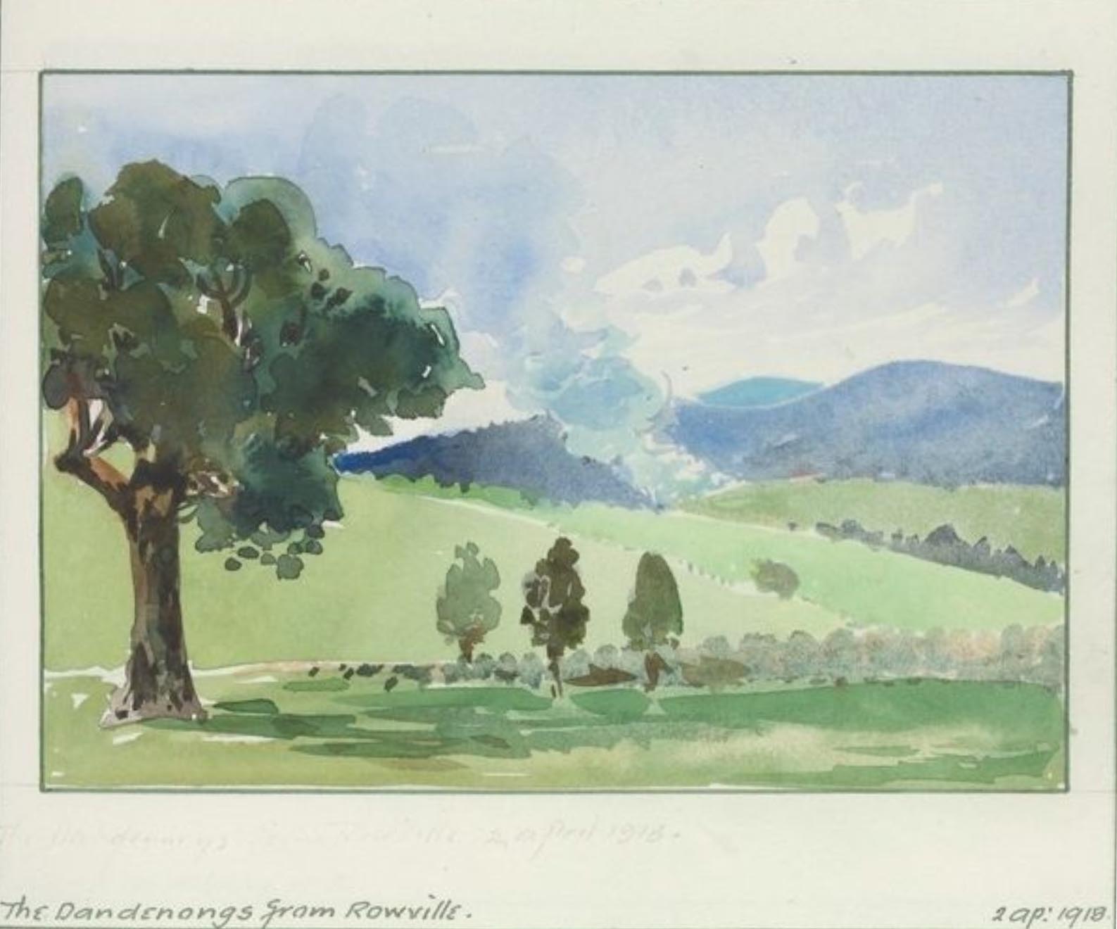
This is a water colour painting entitled “The Dandenongs from Rowville”, and is dated 2nd April 1918. This was painted by artist Robert Joseph Haddon, 1866–1929. This is from the State Library of Victoria collection.
A SHORT HISTORY OF THE ROW FAMILY OF STAMFORD PARK
In 1858, Frederick Row purchased 424 acres of land on the north-western corner of Stud and Wellington Roads for one pound ten shillings an acre.
Frederick’s sons Edward and Richard inherited the Stamford Park property and built the “Stamford Park” homestead in 1882. The name Stamford Park was taken from an estate in England near the town of Stamford.
At Stamford Park Edward bred racehorses and horses for export to India as remounts for the Indian Army. His horses were used in the Melbourne Hunt Club and presented at shows around the Colony winning many trophies.
In 1903 local blacksmith Nicholas Bergin suggested the land and surrounding area take on the name ROWVILLE due to the impact on the area by the Row family.
For further reading on the Row family history head to the RLCN Row Family article.
Preserving Cultural Heritage
Stamford Park was acquired by Knox Council in 1988 and now serves as a heritage site reflecting Rowville’s early European settlement. You can visit Stamford Park Homestead anytime as it is now a fine dining café and restaurant on Emmeline Row off Stud Road.
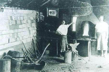
Nick Bergin’s Blacksmith workshop Nick at the forge with his assistant Paddy Fogarty.
Nick Bergin’s blacksmith shop at the south-east corner of Stud and Wellington Roads in the 1930s.
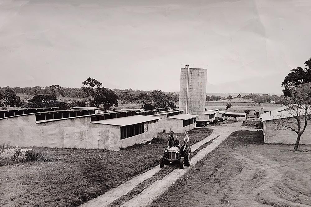
FARMING ON THE SITE OF WELLINGTON VILLAGE BY THE GEARON FAMILY
Jack and Ada Gearon purchased land in Rowville in the early 1920s and built a dairy. They had 9 children who all helped on the farm. Their son Ted, at age 14, started his poultry enterprise by building a few chook sheds and using a humble two-wheeled cart hooked up to a truck to take his eggs to Dandenong market.
Ted grew the poultry business up into a large enterprise that operated throughout the 2nd World War and up until the mid 1960s. In 1965 he wound the poultry down to concentrate on his burgeoning earthmoving business.
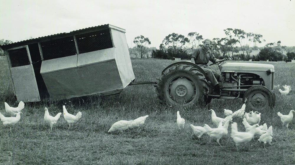
Gearon’s poultry farm – Ted Gearon’s tractor chooks!
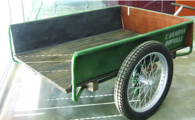
Ted Gearon’s two-wheeled egg cart, used to take his eggs to Dandenong market.
Gearon’s poultry farm.
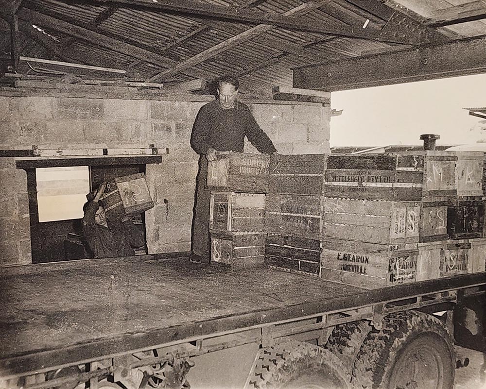
Gearon’s poultry farm – loading the eggs.
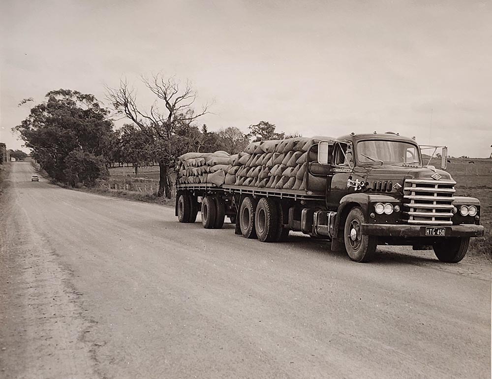
Grain delivery 1950, looking west down Wellington Road near Gearon Avenue.
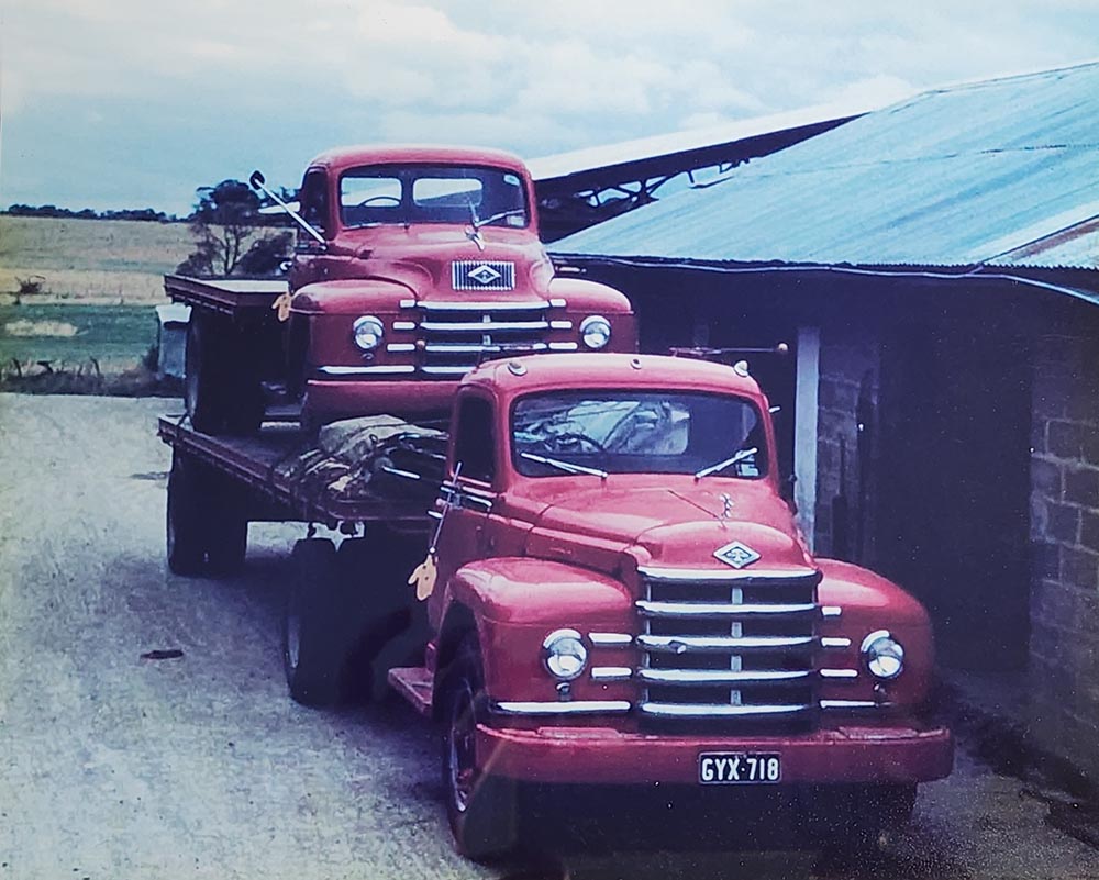
Gearon Transport vehicles 1950s.
WARTIME ROWVILLE
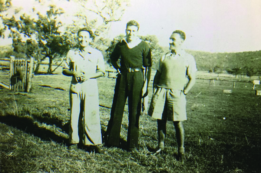
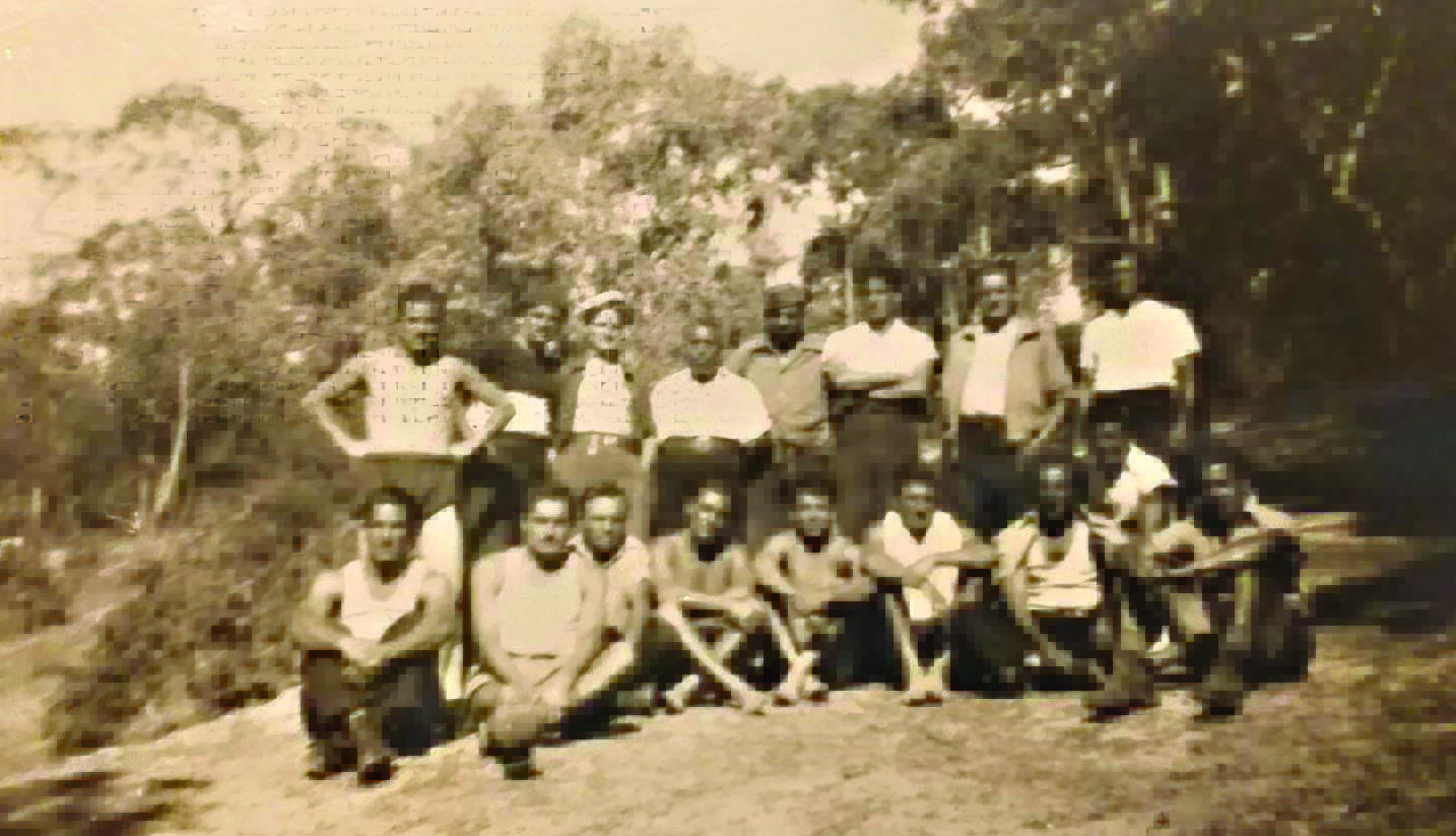
During World War II, Rowville hosted a POW camp for Italian prisoners. This low-security facility played a significant role in the local wartime effort.
THE ROWVILLE ITALIAN PRISONER OF WAR CAMP
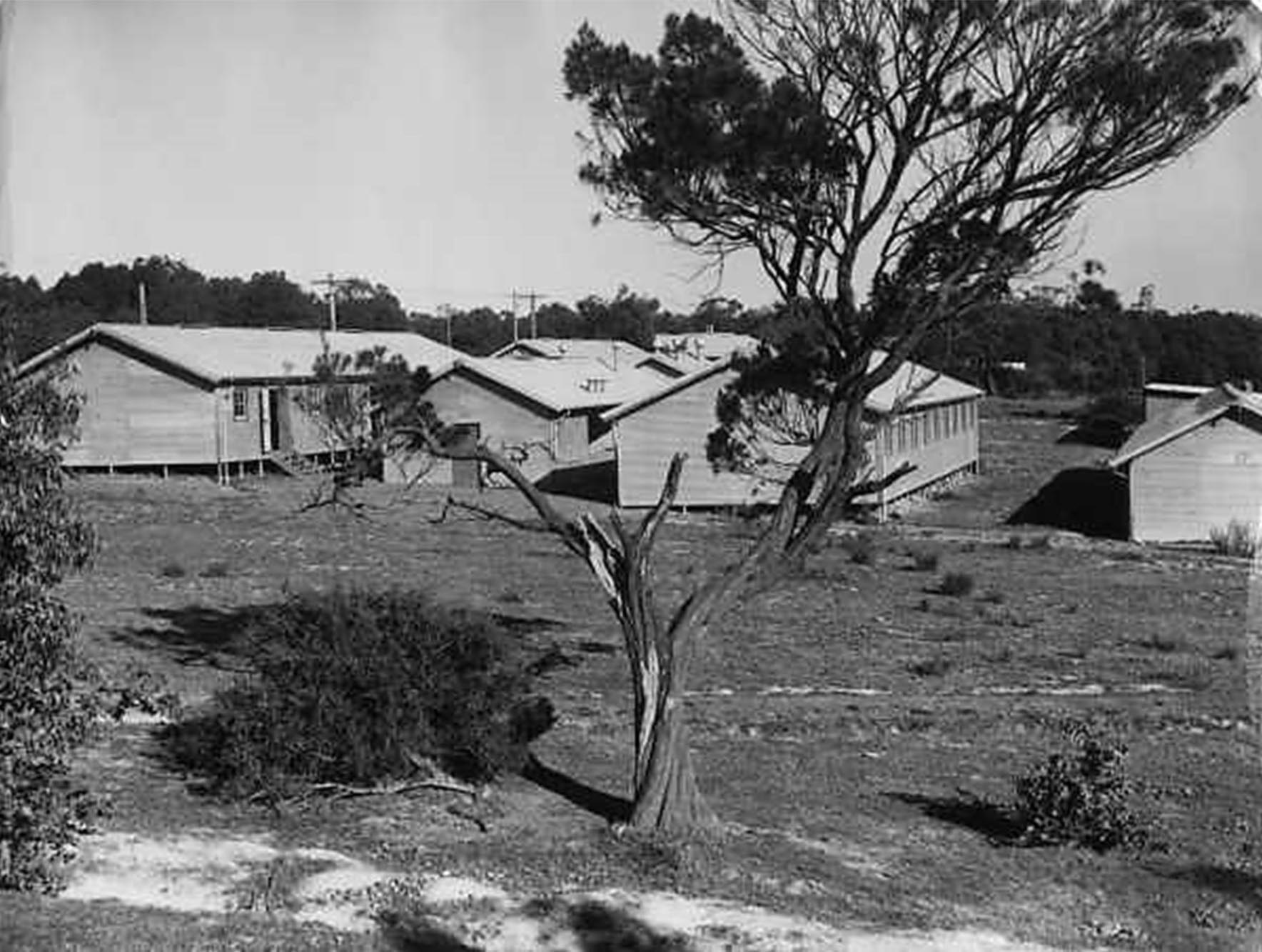
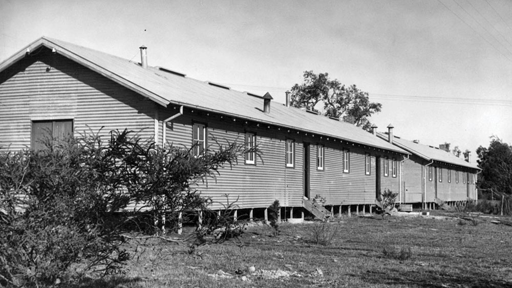
Rowville POW camp buildings along Stud Road, from the Argus newspaper collection of war photographs, World War II, c. 1945, State Library Victoria.
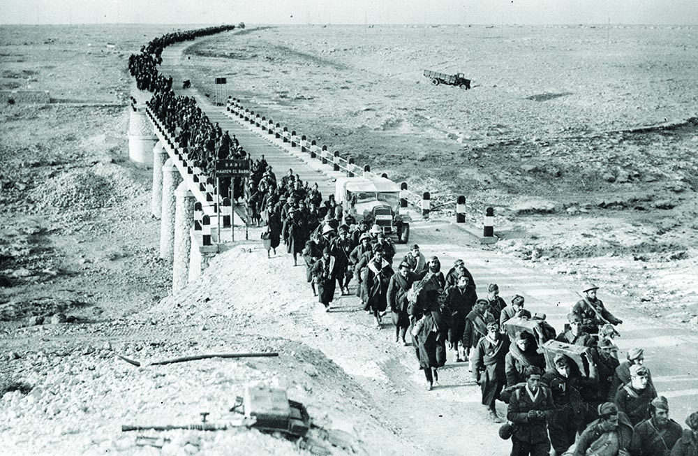
Captured Italian prisoners in Bardia, Libya.
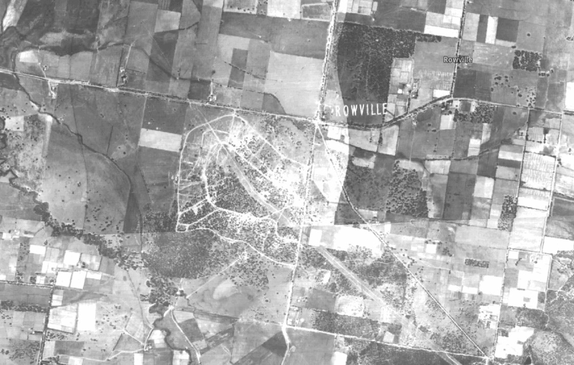
Aerial photo of the POW camp in 1945.
• The Rowville Army camp opened in 1942 and was used initially by the Australian Army, then US Marines before becoming an Italian Prisoner of War Camp in December 1944.
• Over 18,000 Italian prisoners who had been captured in Northern Africa were shipped to Australia. Between December 1944 and August 1946, 2,600 Italian prisoner passed through the Rowville camp.
• The camp was located on the South-Western corner of Stud Road and Wellington Road and extended South into the Timbertop Estate
• The Australian Government implemented an employment scheme for the Italian prisoners, allowing them to work in factories and farms to help with the labour shortage.
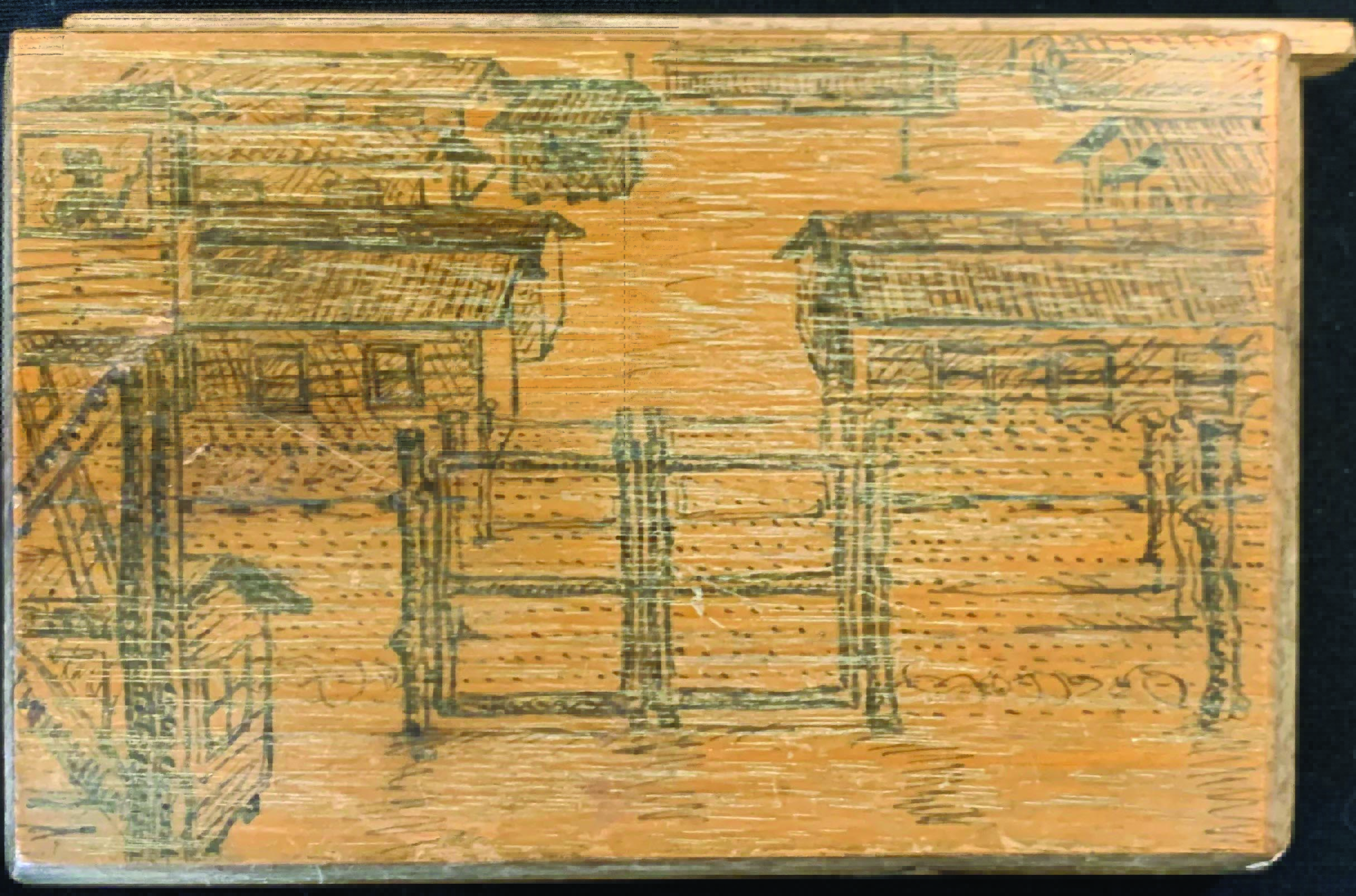
• Various items were made by some of the Italians prisoners in Rowville including model ships in bottles and a wooden cigarette case.
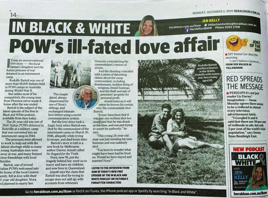
• Shortly after an investigation into allegations of mistreatment of prisoners had been announced, a tragic event took place. On the 30th of March 1946, Rodolfo Bartoli was shot and killed by the Camp Commandant, Captain Waterston.
Content and images about Wartime Rowville courtesy of local historian Darren Arnott.
L–R: Italians Joe Marchiafava, Rodolfo Bartoli and unknown man in the present location of Wellington Village Shopping Centre.
Italians after a swim at nearby Heany Park Lake.
 .
. 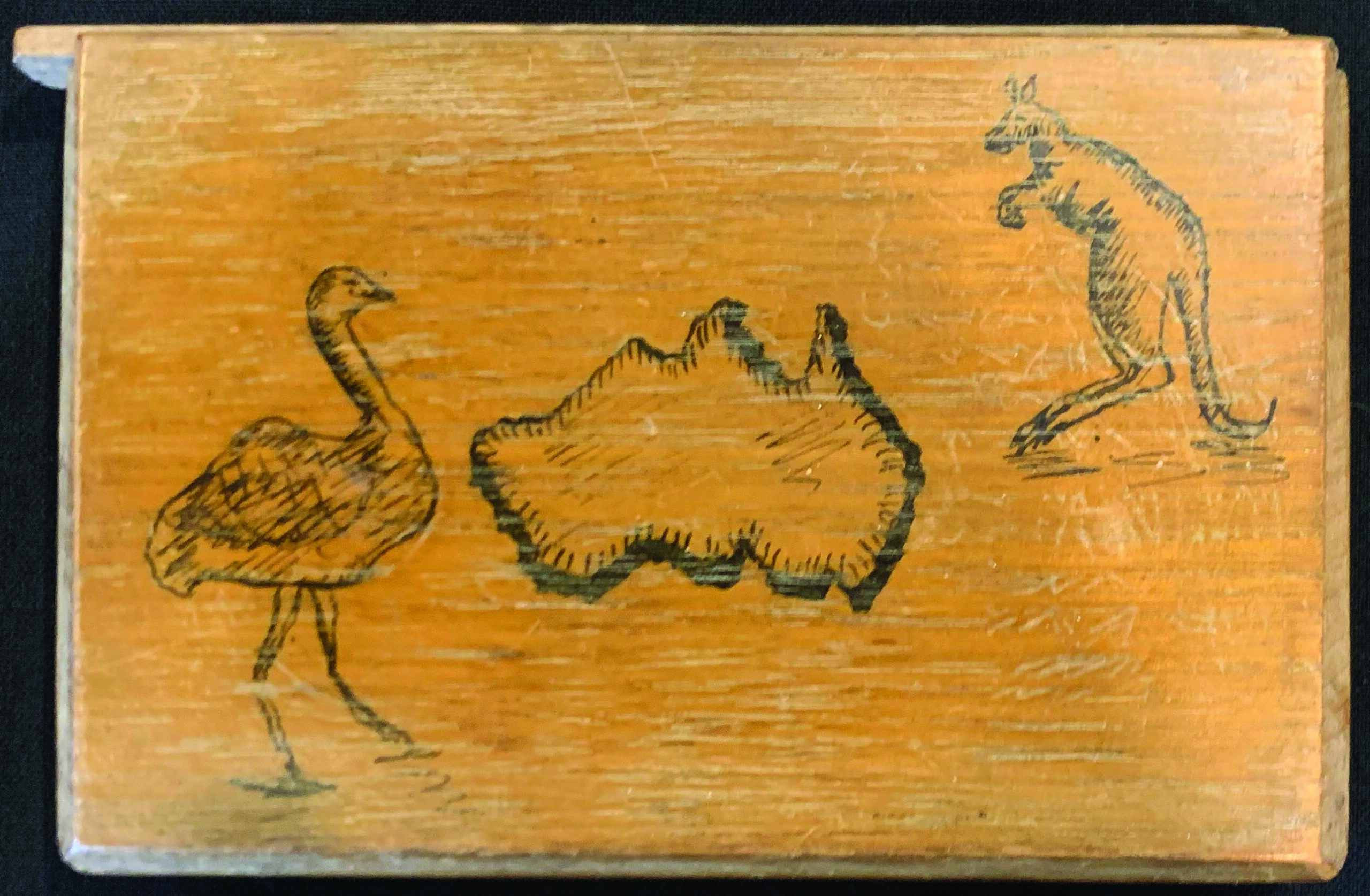
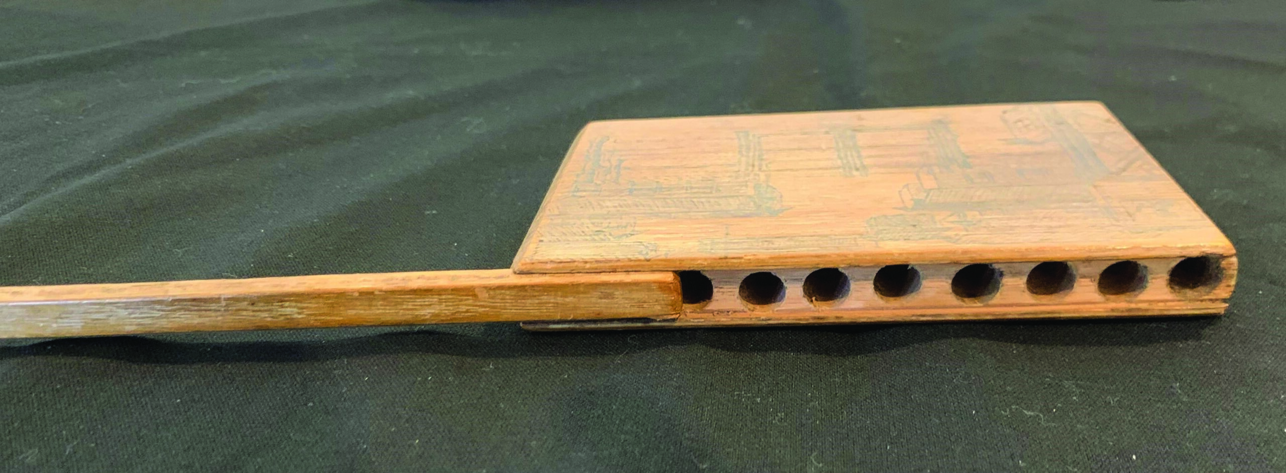
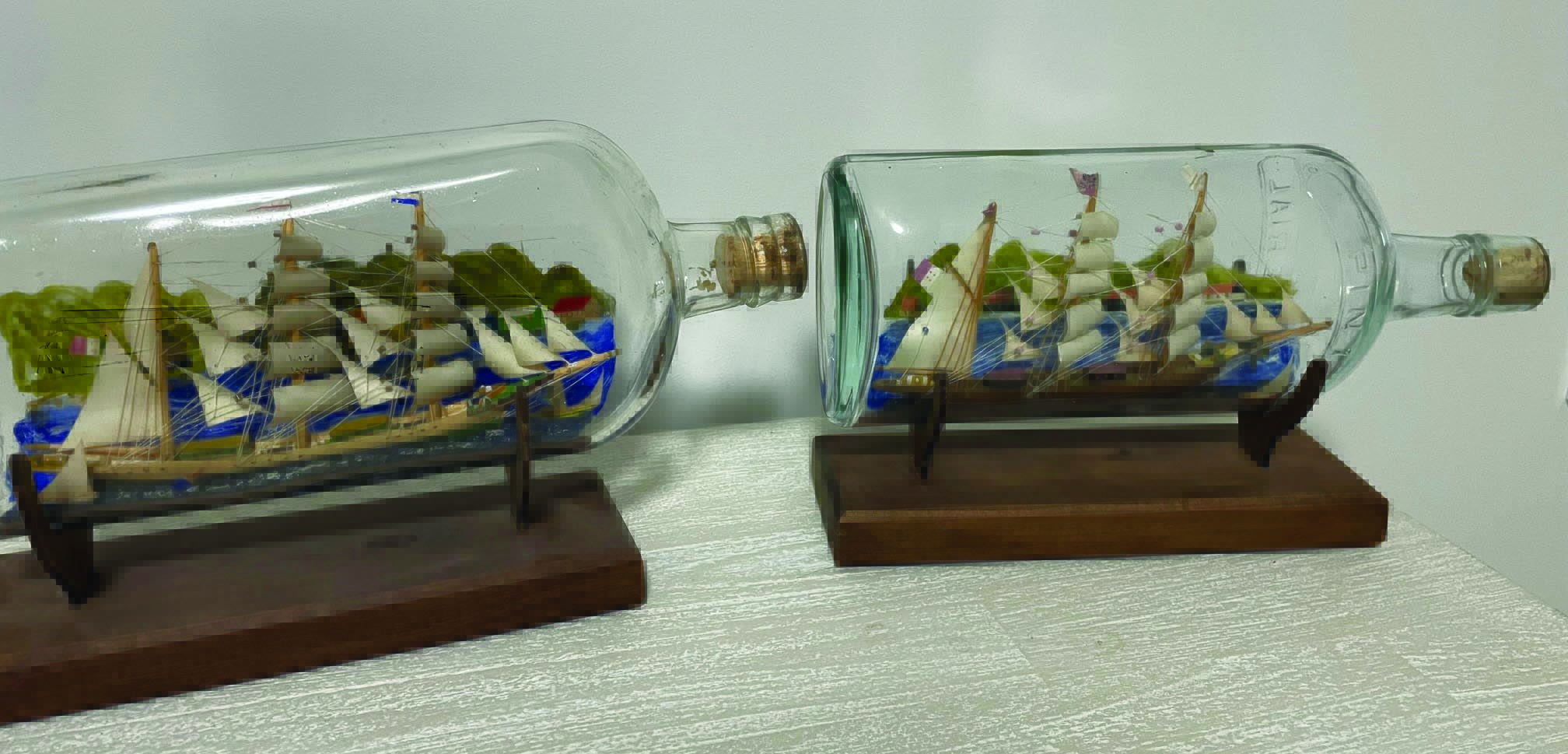
Items made by some of the Italians prisoners in Rowville.
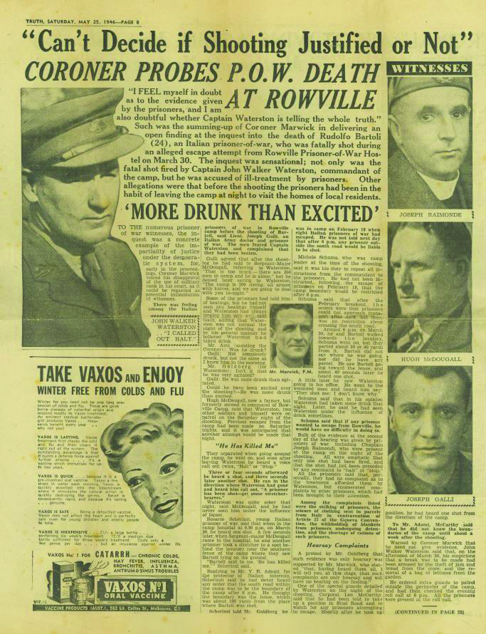
Article about the shooting from the ‘ Truth’ Newspaper, May 25 1946 page 8.
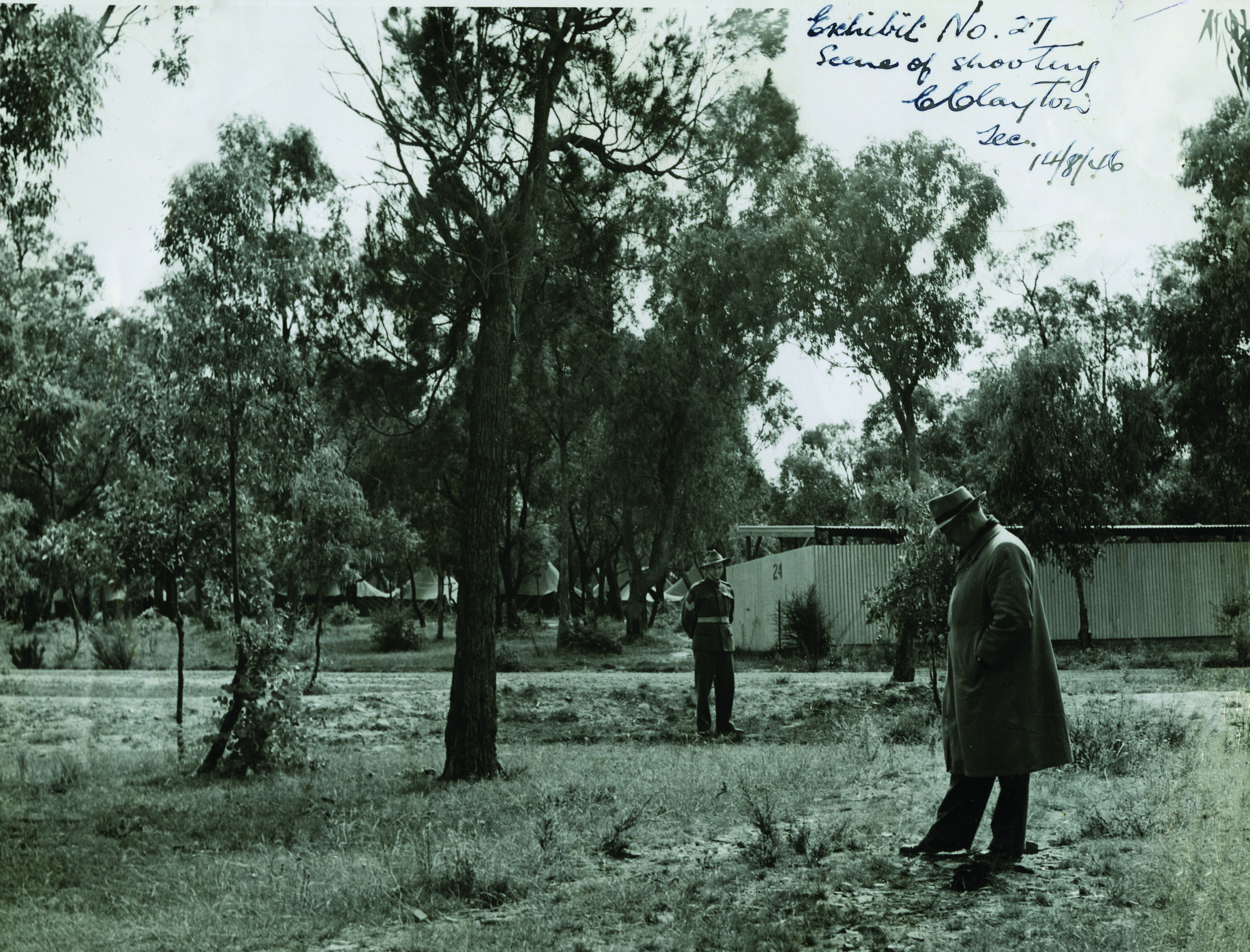
The scene of the shooting with prisoner tents and a latrine block in the background. This location is at Starlight Reserve.
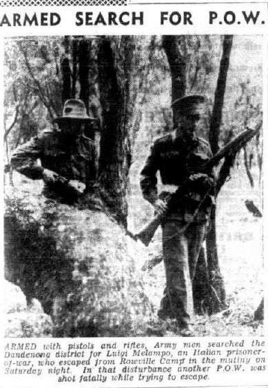
News clipping about the armed search for the escaped Italian POW Luigi Melampo.
See links for more information and stories about the camp.
Click here to listen to the ‘In Black & White’ Podcast
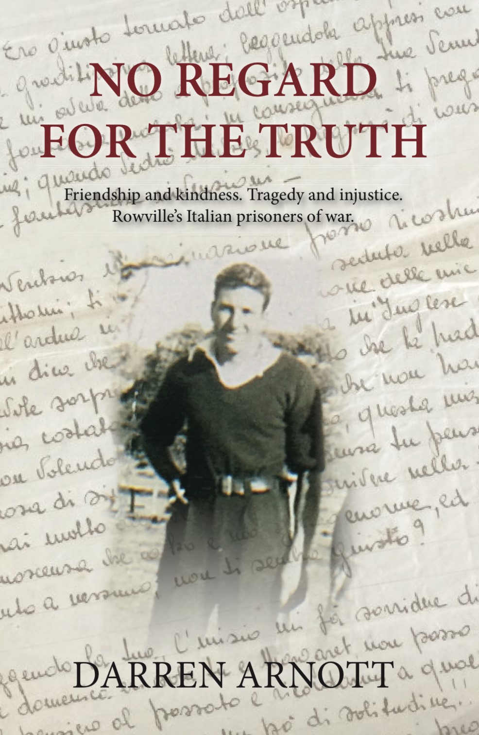
‘No Regard for the Truth’ by Darren Arnott explores the history of the camp and Rodolfo’s story.
For more information or to purchase the book go to: www.darrenarnott.com
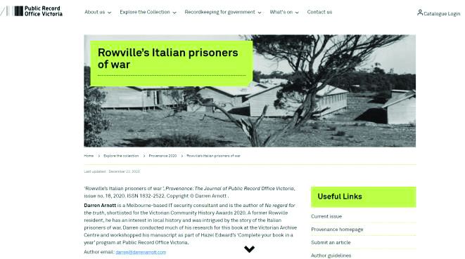
A Public Record Office Victoria publication about the camp.
LOCAL NEWS & HISTORY
HISTORIC WELL
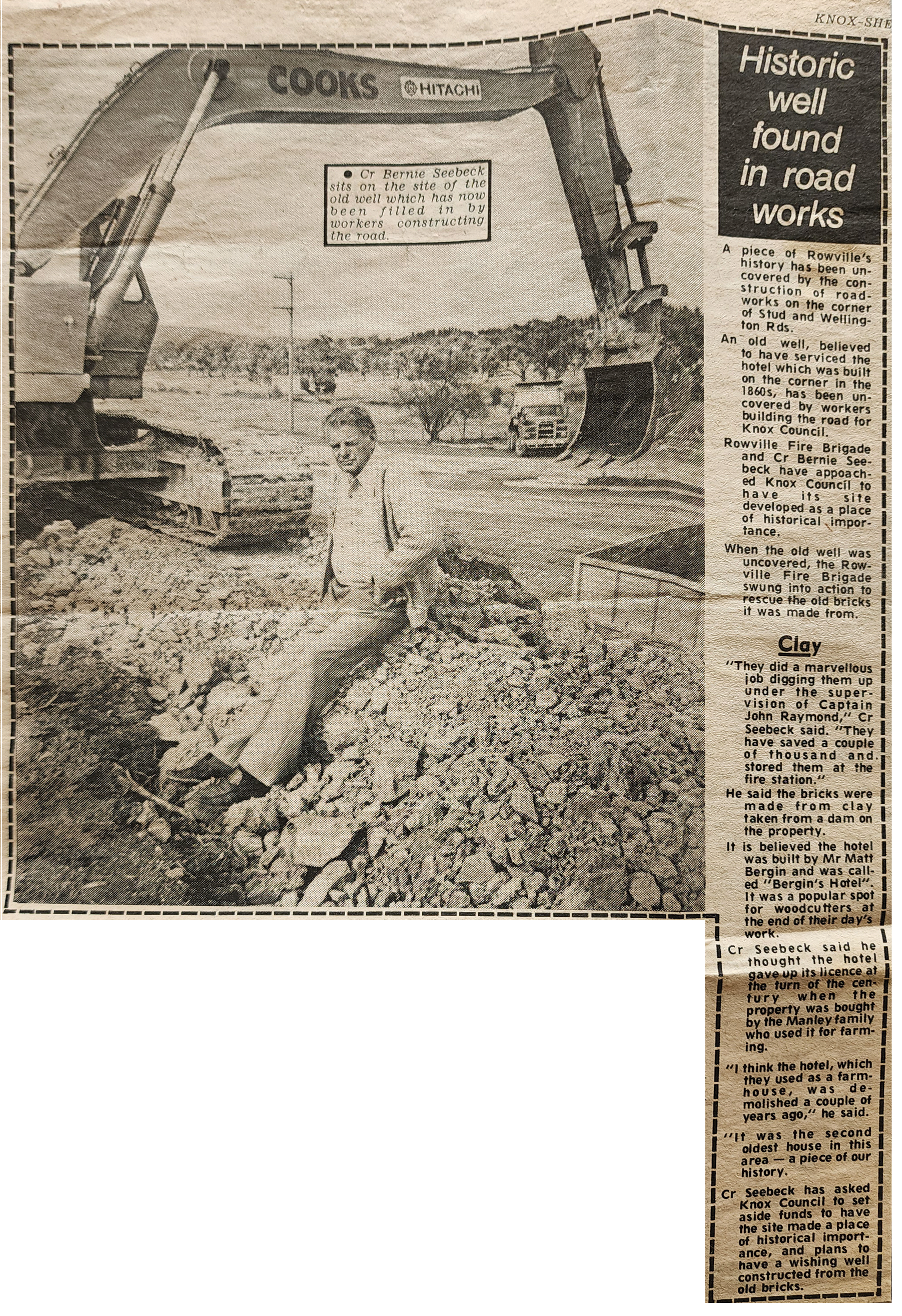
News article about the historic well found during road construction on Stud Road.
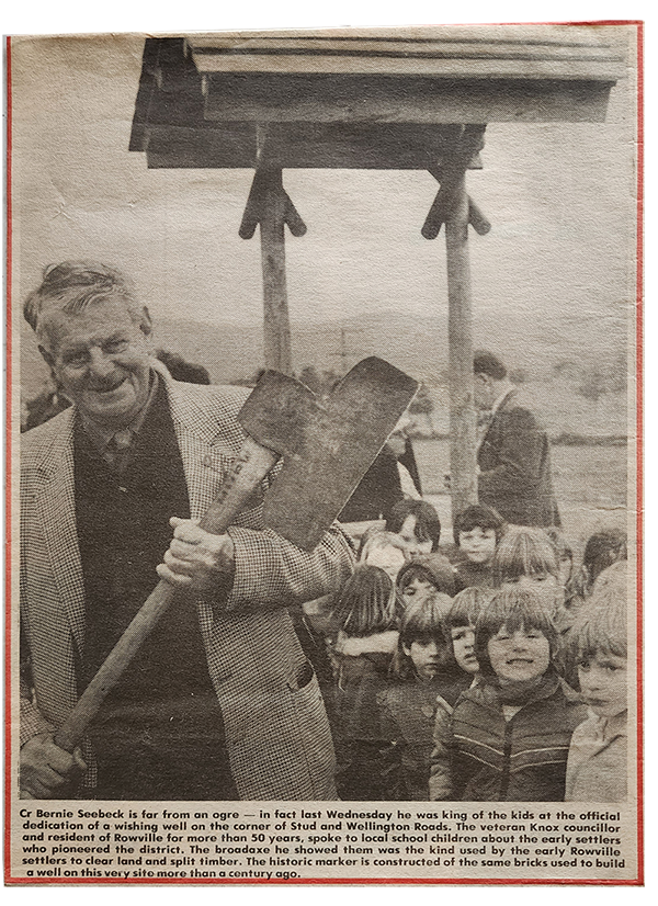
New wishing-well built with the old bricks from the historic well.
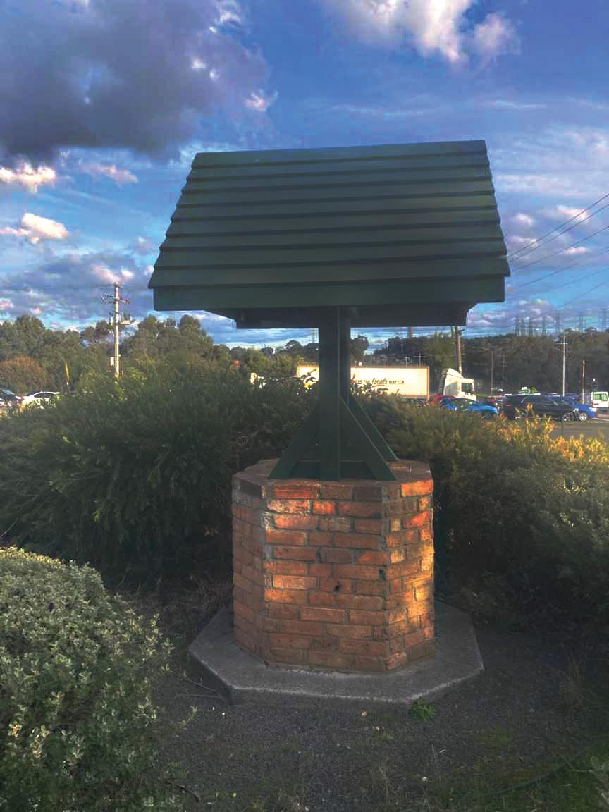
The well still exists today located on the corner of Stud and Wellington Roads near the 7-Eleven service station.
Click here to read a more detailed history of the well.
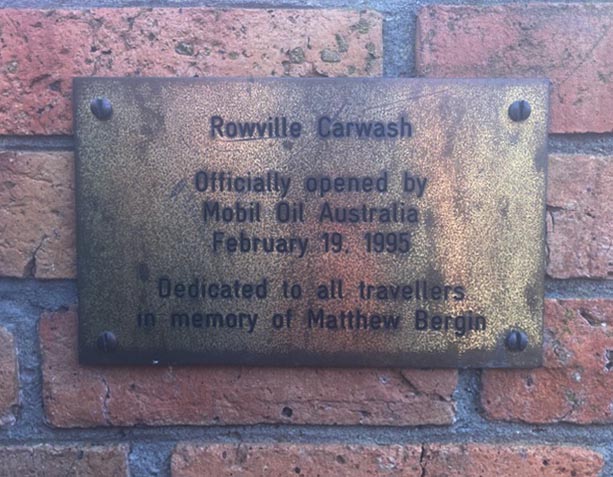
Plaque on the well in memory of Matthew Bergin. The original ancestor of the Bergin family in Rowville.
COMMUNITY CENTRE
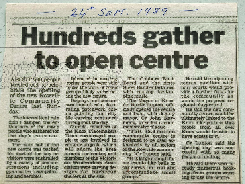
News clipping about the opening of the Rowville Community Centre in 1989.
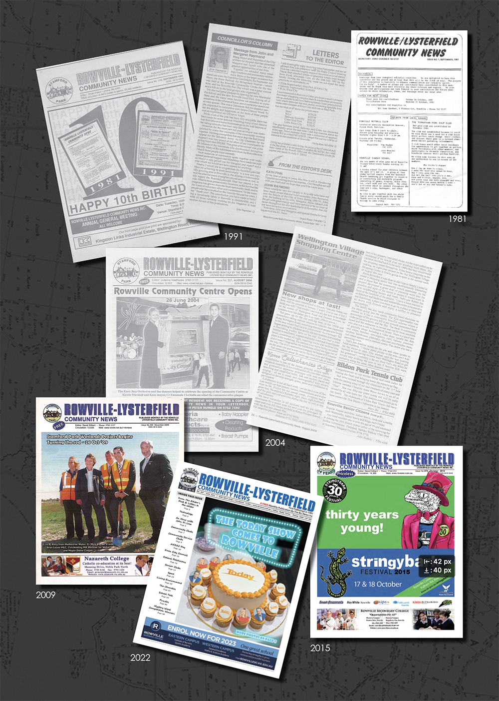
ROWVILLE-LYSTERFIELD COMMUNITY NEWS
The Rowville-Lysterfield Community News (RLCN) was started as a free double-sided sheet in 1981 and increased to 7 double-sided sheets in 1983. A new A4 style format was adopted in 1983 consisting of 16 pages using advanced print technologies. By the time the paper went “Blue” in 1991 they were printing 24 pages. In 2009 they took the bold step to fully utilise updated printing methods and moved to full colour tabloid size paper of 28 pages.
Today, the paper is still free with 28 pages of colour covering articles of general interest, historical memories, church news, sporting updates and school activities. It is produced by a team of dedicated people and is delivered by volunteers to in excess of 15,000 homes and businesses in the suburbs of Rowville and Lysterfield. It is produced on a not-for-profit, volunteer basis and receives no government financial assistance.
Throughout our history they have won many Knox Pride Awards and in 2000 were granted a Bicentennial Government History Grant that resulted in fascinating research of the area and culminated in a three volume history book of Rowville and Lysterfield.
Content and images about RLCN courtesy of Rowville-Lysterfied Community News
HEANY PARK
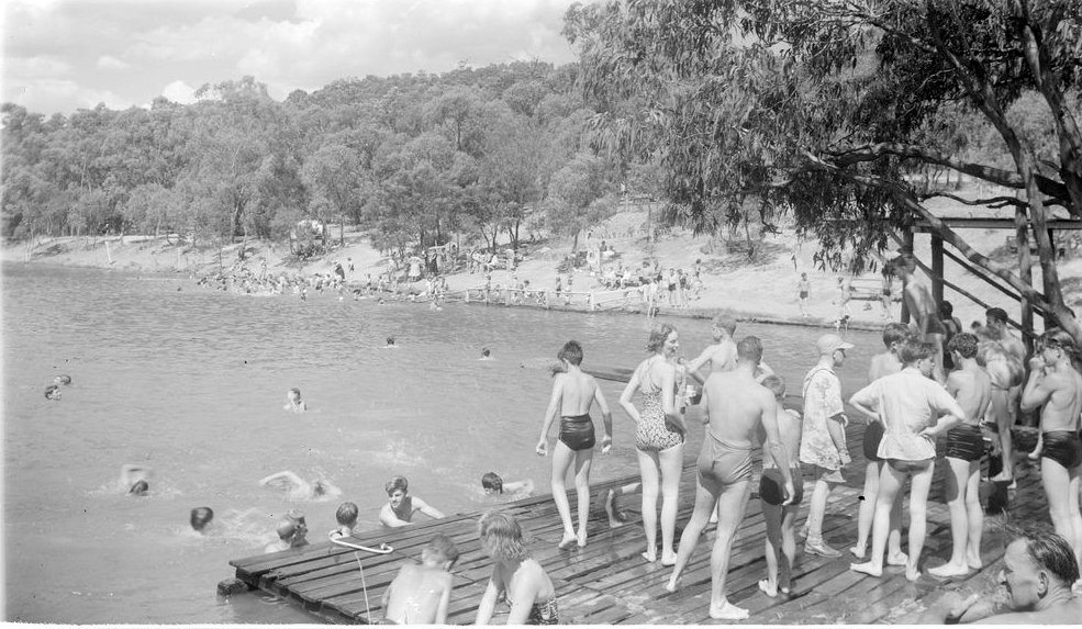
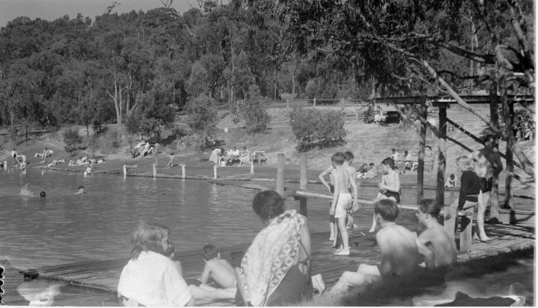
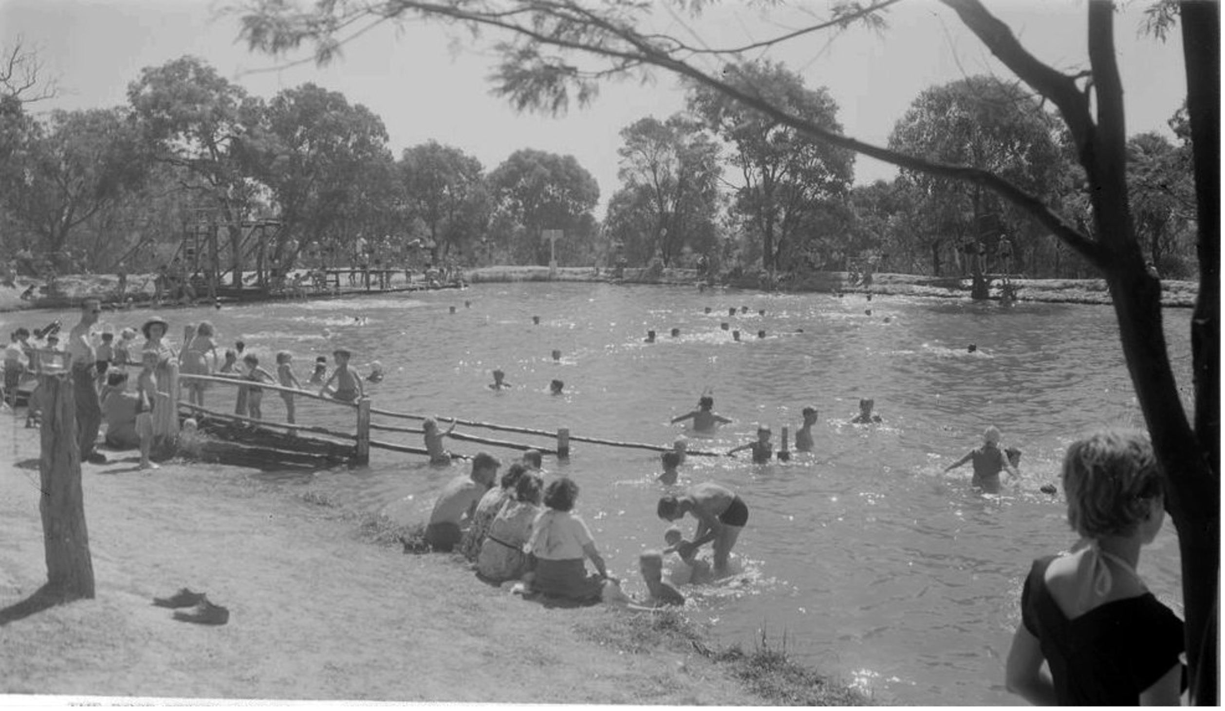
Heany Park Lake c1952. Now home to the Heany Park Scout Group, Heany Park once was a popular Swimming Carnival location in the 1950s–60s.
The Belgrave Reservoir was constructed about 1893 and a storage basin was put in near the junction of Bergins and Police Roads in 1914 to improve water quality. The scheme was decommissioned in 1924, but the water was made available to dairy farmers until about 1946.
The creek users wanted water to flow down the creek, but the pipeline users disagreed. In addition, holiday makers and residents wanted the reservoir as a swimming pool. The dairy farmers had concerns that swimmers would cause pollution.
The State Rivers, tired of the complaints and constant wrangling, threatened to remove the pipeline altogether but Ferntree Gully Shire Council, pressed by Councillor Violet Lambert, sought a lease of the pipeline and this was granted from 1940–1950.
As the time for the lease to expire drew closer, Cr Lambert thought up a scheme to ensure water would be safe for Lysterfield farmers. In 1946 she instigated the holding of annual Swimming Carnivals at the old storage basin and successfully moved in Council that the area be used for recreation purposes and named after the Shire Engineer, Tom Heany, in the hope that this would encourage him to take an interest in its development.
The Carnivals helped finance the maintenance of the pipeline. The whole scheme was totally self-supporting and instead of polluting the water, people could now swim at the end.
It is not known when these annual Carnivals stopped, or when the local people lost interest in the park but it is thought to be around 1957.
Following the closure of the lake as a swimming centre, public access was removed in the early 1960s. The lake and surrounding bushland was made available for scouting activities in 1986.
![]()
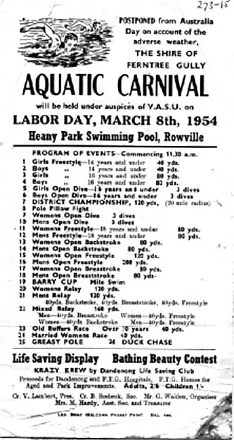
Heany Park advertisement for Carnival 1954 (Argus).
THE ROWVILLE DRIVE IN THEATRE
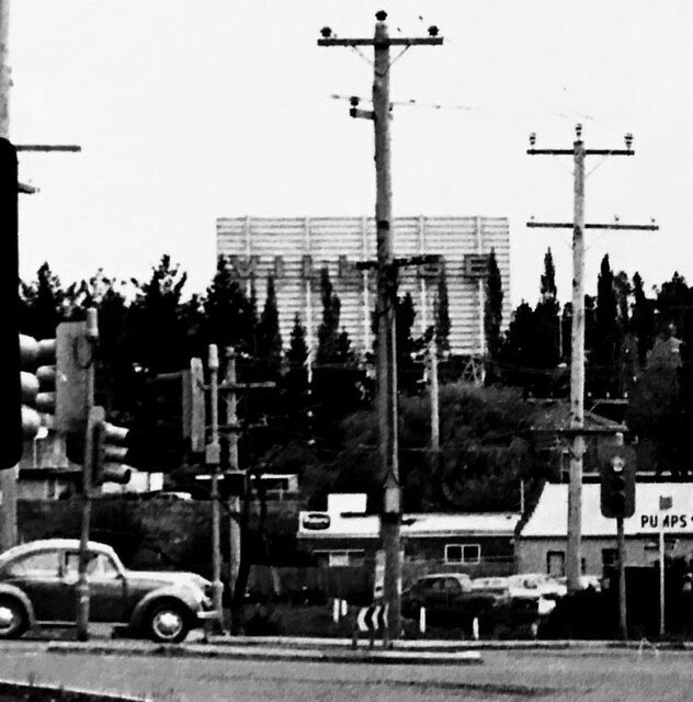
View of the Village screen from the Stamford Hotel circa 1960s.
The Rowville Drive In Theatre was the brain child of Stewart Finn who was able to persuade his father that the family’s thirty acre property lying in a triangle between Stud and Bergins Roads would be an ideal site so they put the proposal to Village Drive Ins. This occurred in 1956, the year of the Melbourne Olympics.
The Rowville Drive In was officially opened on a cold July night in 1956 by Sir George Knox followed by a parade of entrants in the Dandenong Hospital Beauty Queen competition. The evening’s “smash-hit, double feature show” was ‘Rear Window’ starring Grace Kelly and James Stewart plus Betty Hutton in ‘Red Hot and Blue’.
The Drive in had a playground, miniature train and a large cafeteria with a chef employed to oversee the meals of steaks, grills, fish and chips and salads. The Drive In was such a novelty in the early days that both sides of Stud Road would be bumper to bumper with cars stopped while their occupants watched the film.
Carhops were the guys who ushered the cars into their spots and cleaned the windscreens. People sometimes tried to get passengers in for free, hiding them in boots of their cars or down behind the seats but the carhops were a wakeup to these tricks. There was car service during the first half of the show and the carhops would go to the cars with a red light on the speaker pole, take the order and deliver it to the car so the occupants did not have to miss any of the show.
As anticipated by the directors, the Drive In did survive the early television era but eventually succumbed in 1983 as more and more homes were equipped with colour TVs and video players.
Scan the QR code to read more.
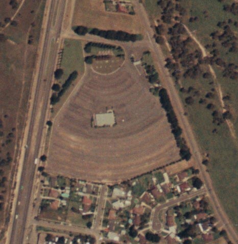
Aerial view of the Drive In showing Stud and Bergins Roads.
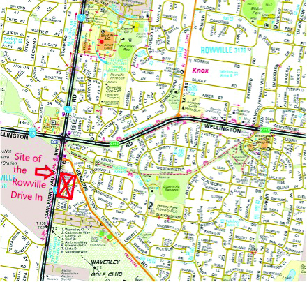
Current map of Rowville showing location of the old Drive In theatre.
OLD ROWVILLE MAPS
The land now known as Rowville, was originally titled as the Parish of Narree-Worran in the County of Mornington. It changed to become part of Lysterfield in the 1870’s. In 1903, Blacksmith Nicholas Bergin petitioned the government for a local post office. He came up with the name ‘Rowville’, after the Row family of Stamford Park
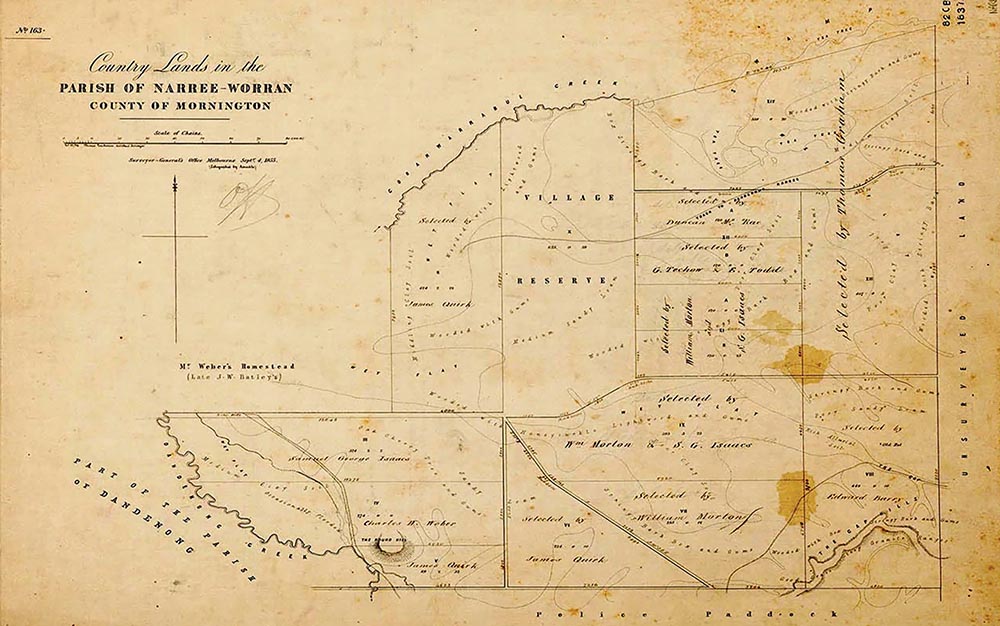
MAP: Parish of Narree-Worran 1855.
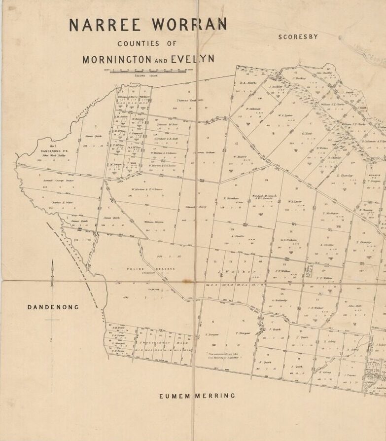
MAP: Narree Worran, Counties of Mornington and Evelyn, Dept. of Lands and Survey 1892.
Rapid expansion of residential housing from 1968
Farming in Rowville disappears as housing developments begin.
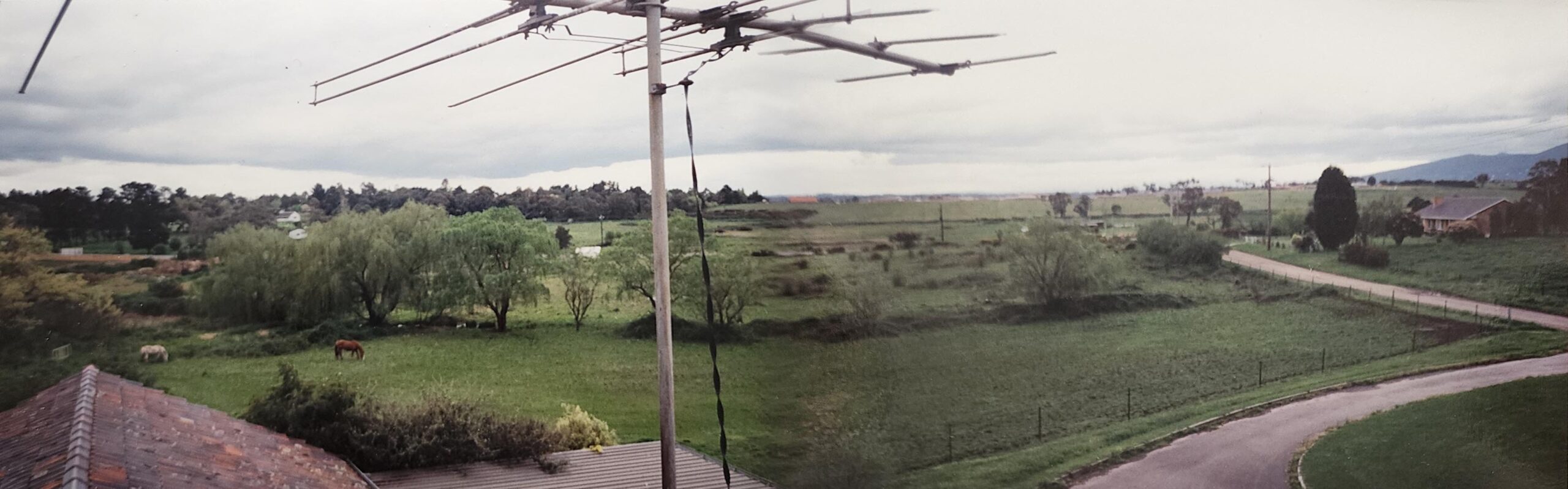
Photo taken in the 1980s from the Gearon’s home and future Wellington Village Shopping Centre site looking north towards Wellington Road.
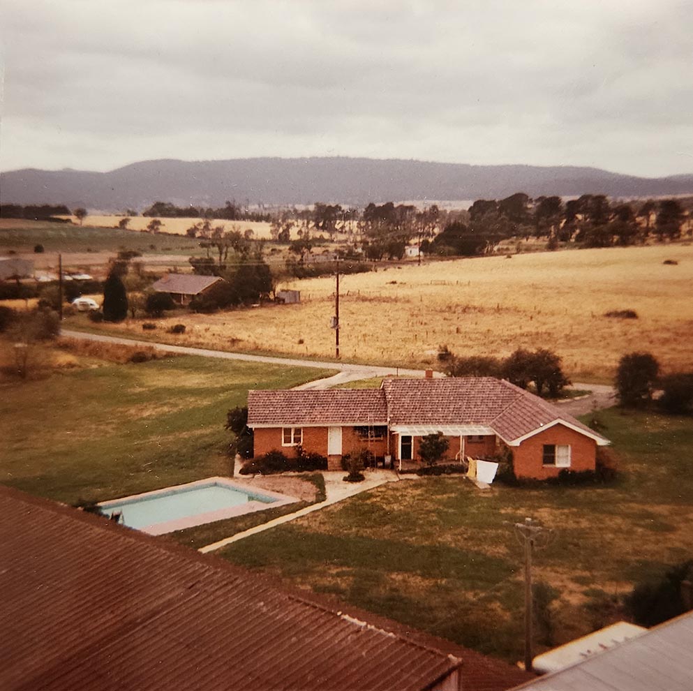
Photo taken around early 1990s looking north-east towards the Dandenongs from Wellington Village Shopping Centre site showing the Gearon’s home built in 1961.
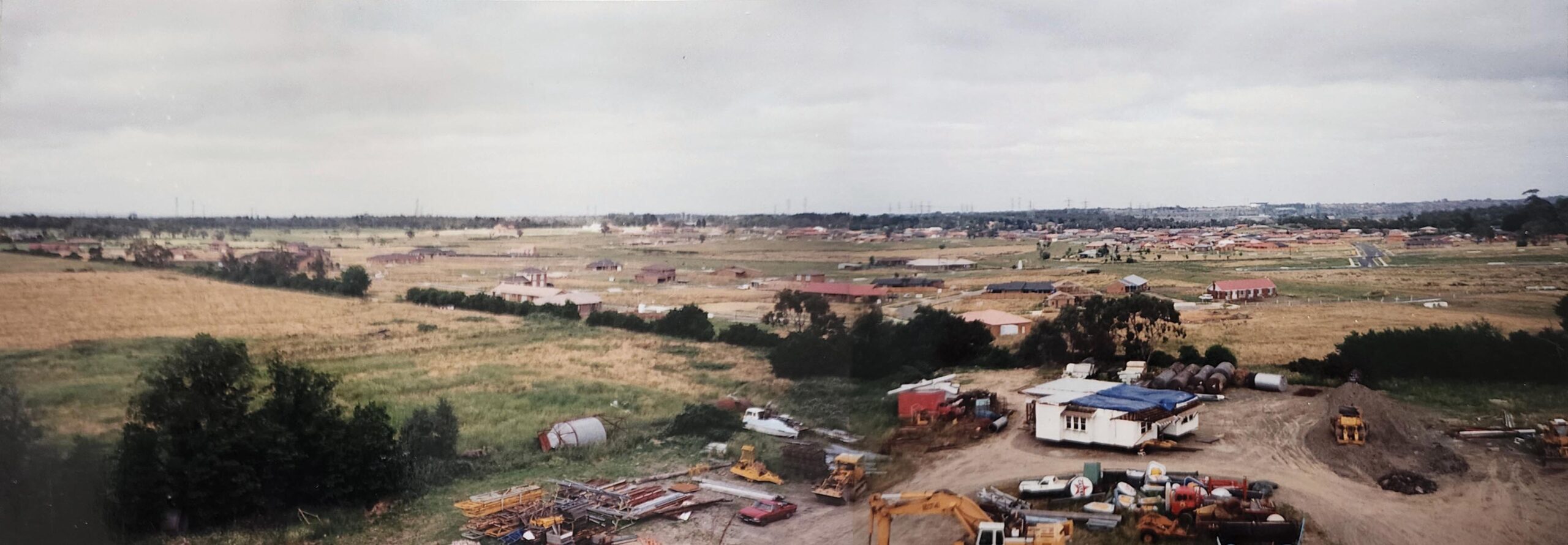
Photo taken in the mid 1990s from the Wellington Village Shopping Centre site looking south-west towards Bergins and Stud Roads showing the growing housing developments.
BUILDING WELLINGTON VILLAGE
Wellington Village Shopping Centre commenced construction in February 2004 and opened on Monday 16th August 2004.
STAGE 1 designed by George Yiontis from Coy+Yiontis architects, consisted of the main building from the Medical centre up to Eating House. It spent a good 4 years in design and planning and took 6 months to build.
STAGE 2 saw the commencement of the Childcare Centre along Gearon Avenue in 2006.
STAGE 3 was the development of Aldi, extension of Ritchies, and the addition of another 5 shops, this all took place in 2010.
THE FINAL STAGE 4 commenced construction in 2014, a full 10 years from stage 1, this was the construction of The Corner Wellington Village, a two story curvy building on the corner of Braeburn Parade and Wellington Road that houses Anytime Fitness gym and 9 other shops.
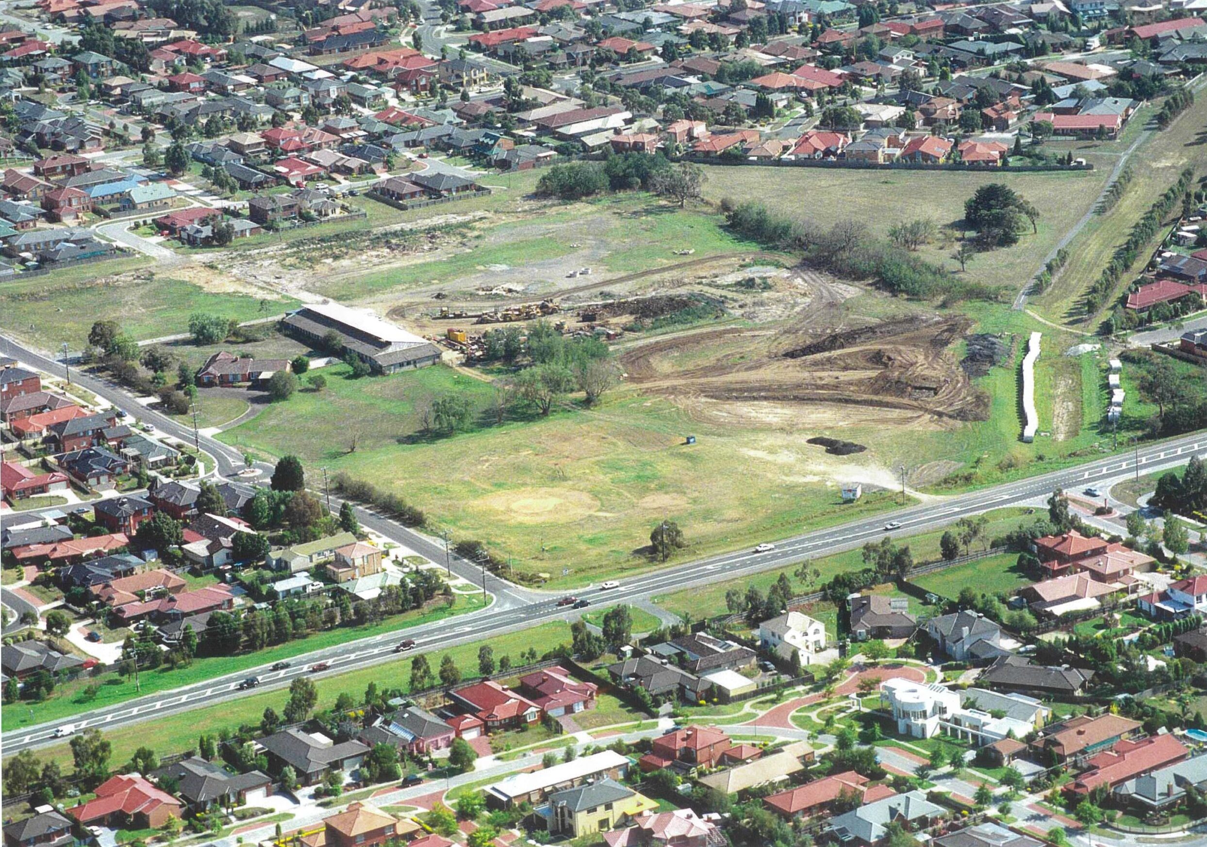
Photo circa 2001.
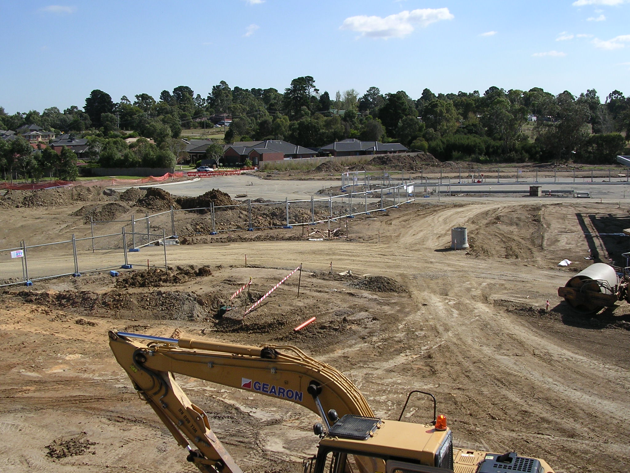
February 2004 – The groundwork begins.
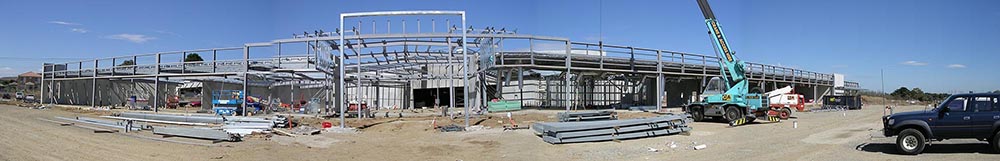
2004 Wellington Village Shopping Centre construction.
2010 – Ground works for ALDI extension begins.
2004 stage one nears completion.
2013
April 2012 – Completion of ALDI
Aerial photo shows the new building ‘The Corner’ completed in 2015.

2014 The Corner – framework nears completion.
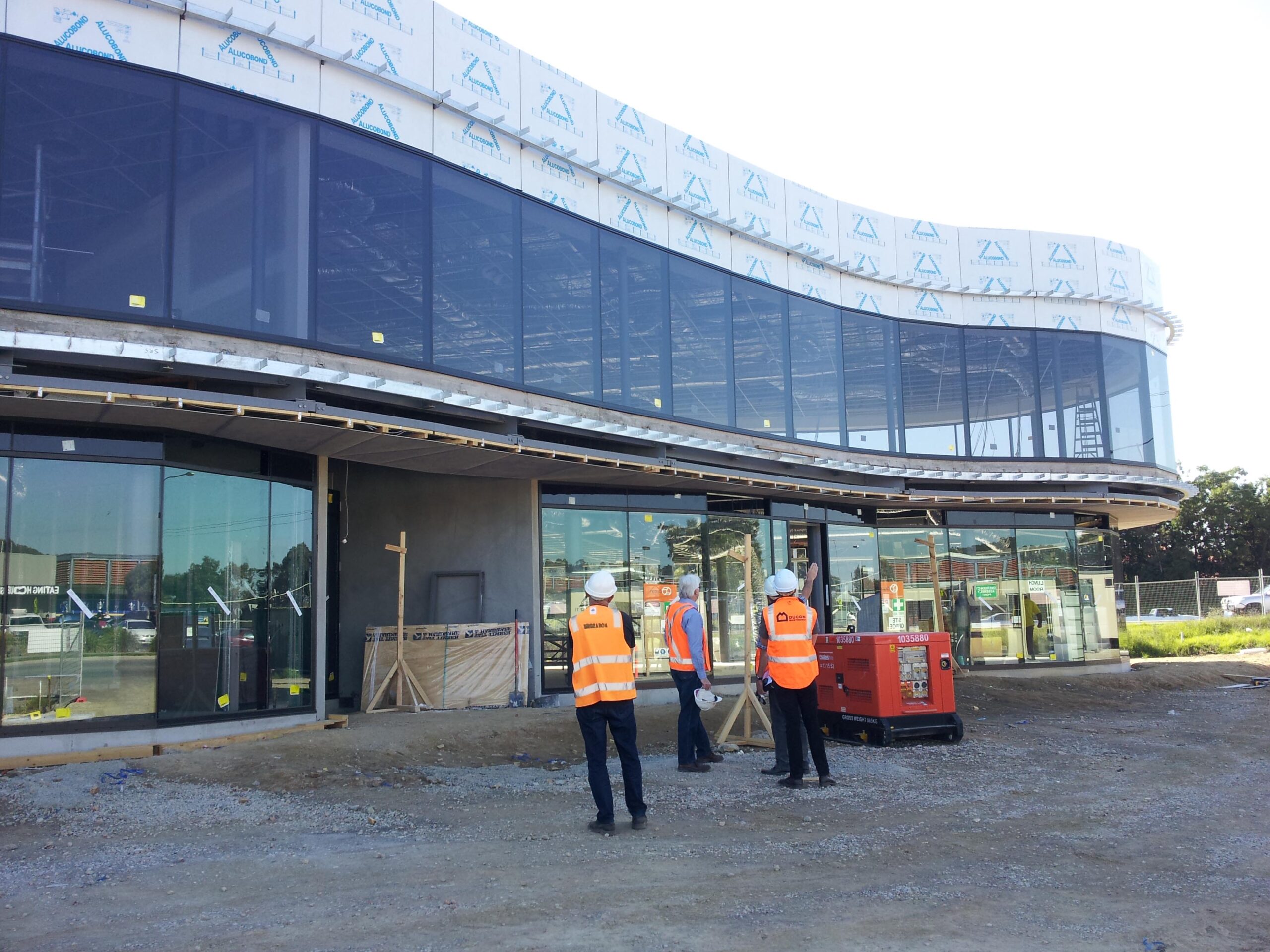
2014 The Corner – glazing installation.
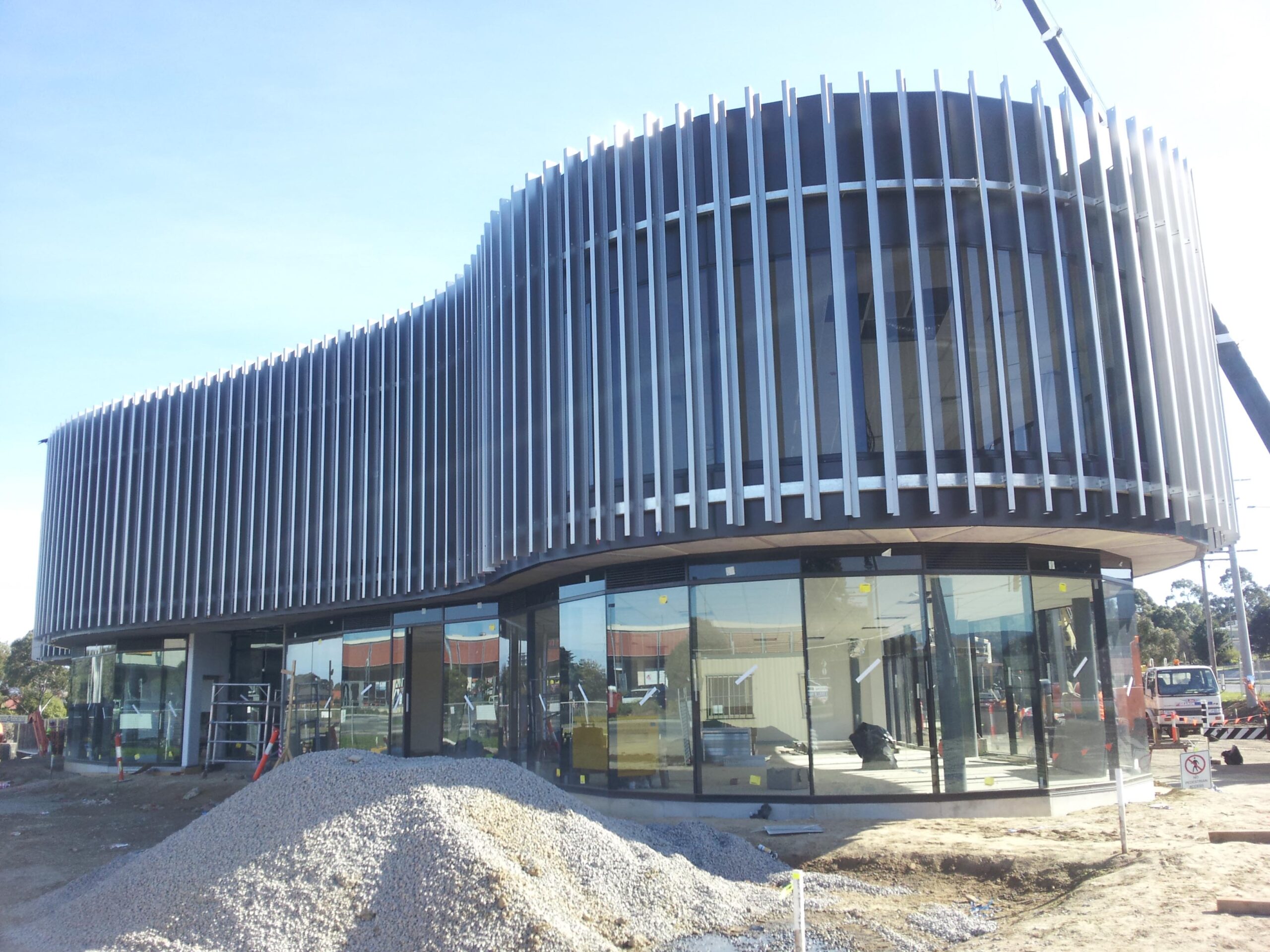
2014 The Corner – vertical CORTEN blades completed.
Aerial photo shows the new building ‘The Corner’ completed in 2015.
MODERN WELLINGTON VILLAGE
Today, Wellington Village is a thriving community centre, home to major retailers, specialty shops, restaurants, and health services. It supports local charities and community events, fostering a strong sense of community. With modern amenities and a rich historical background, Wellington Village continues to be a central part of Rowville’s daily life.
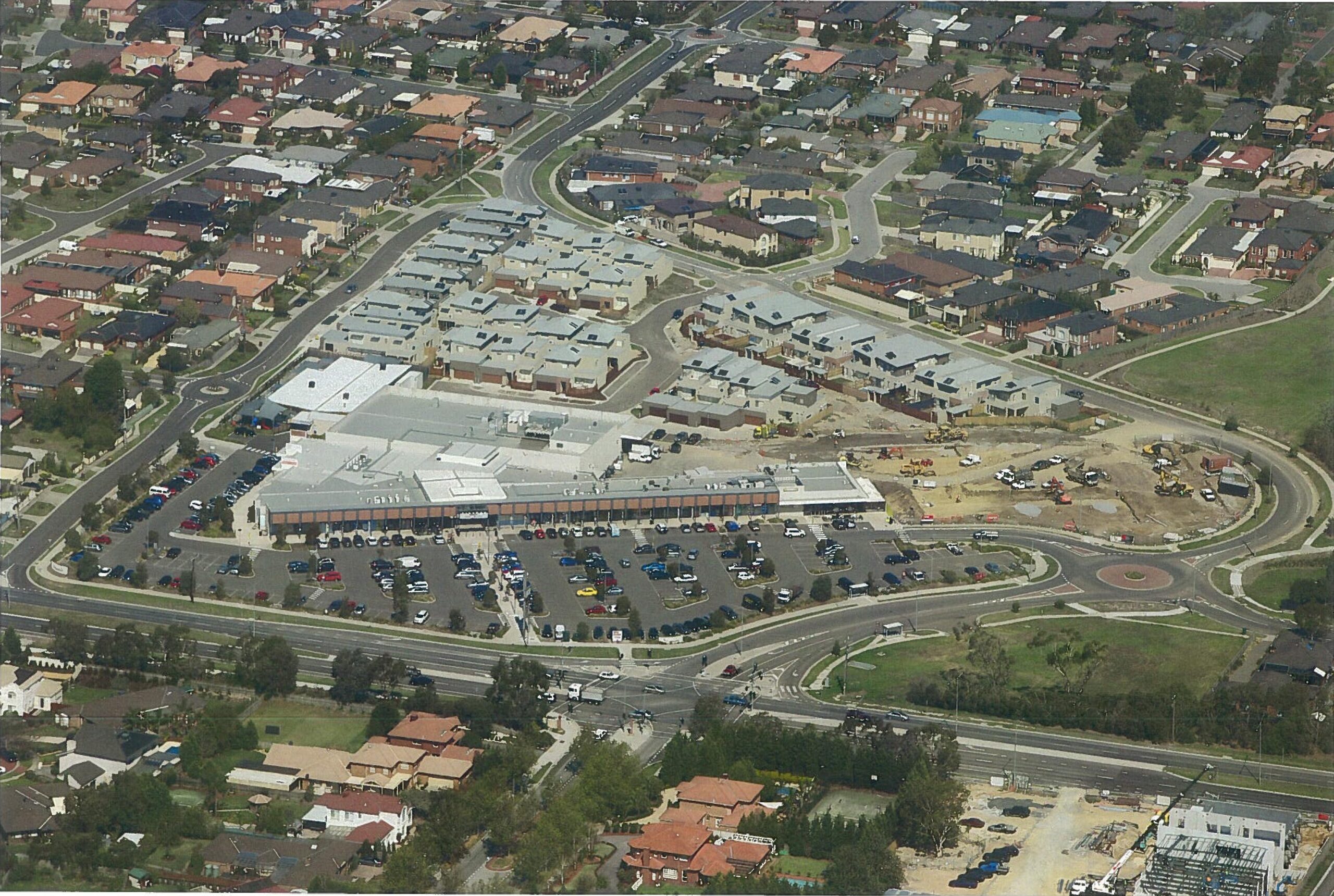
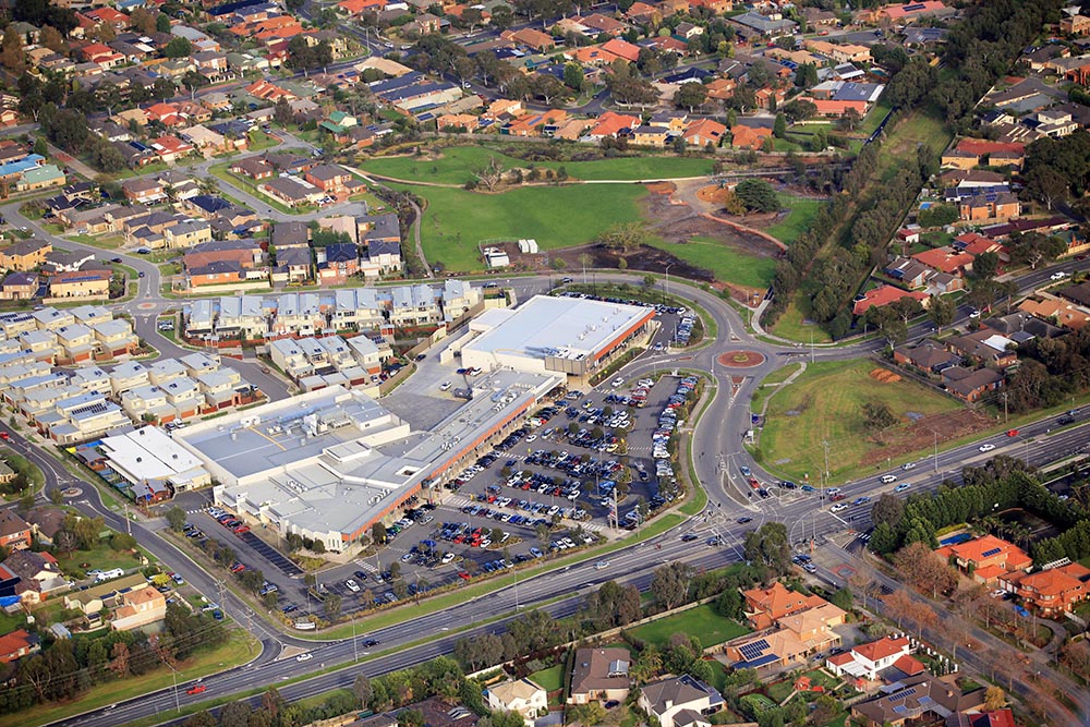
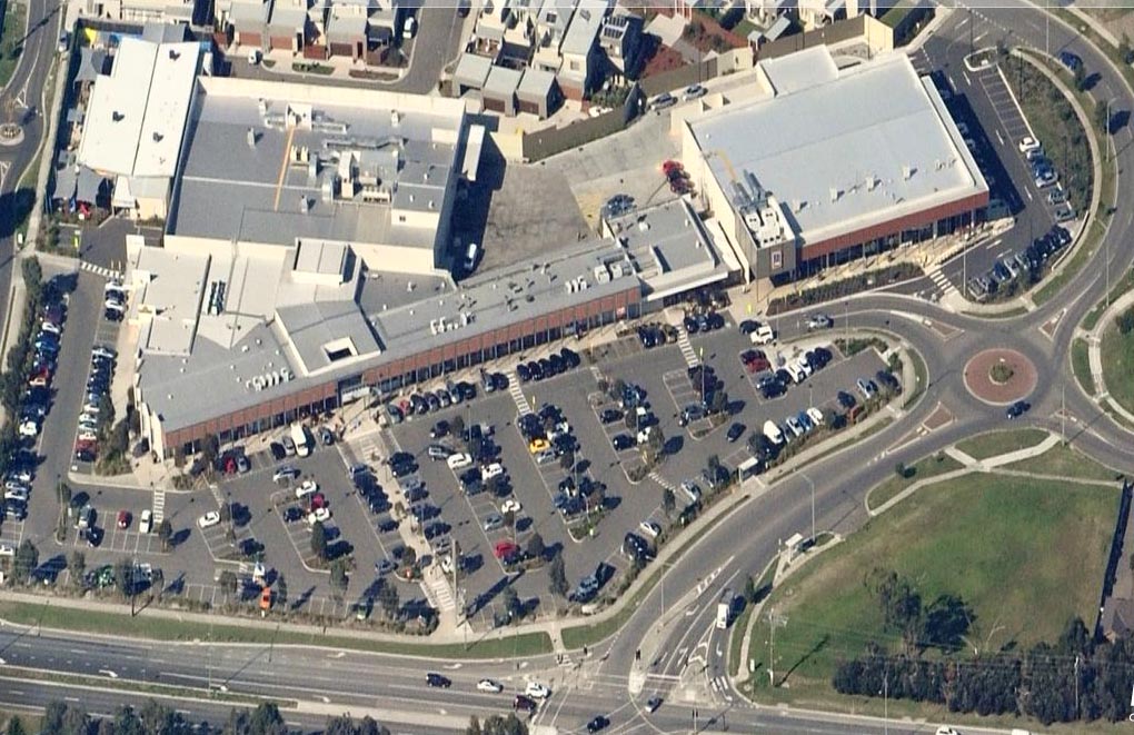
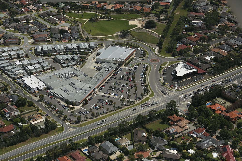
A Bird’s Eye View of Rowville
The aerial images below showcase the vibrant and developed landscape of present-day Rowville. From residential areas to commercial hubs like Wellington Village, the images highlight the community’s growth and the seamless blend of modern living with historical significance.
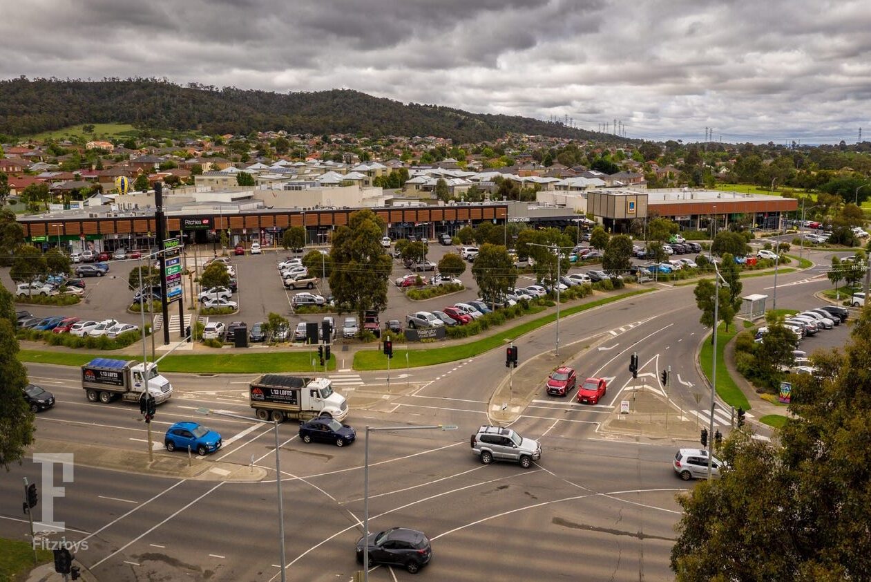
Wellington Village Shopping Centre aerial image present day.
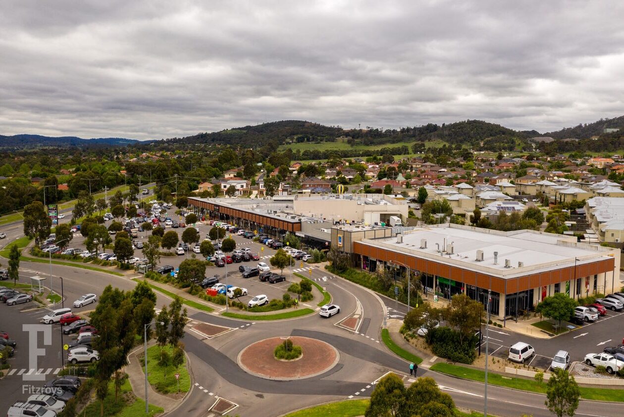
Wellington Village Shopping Centre aerial image present day.
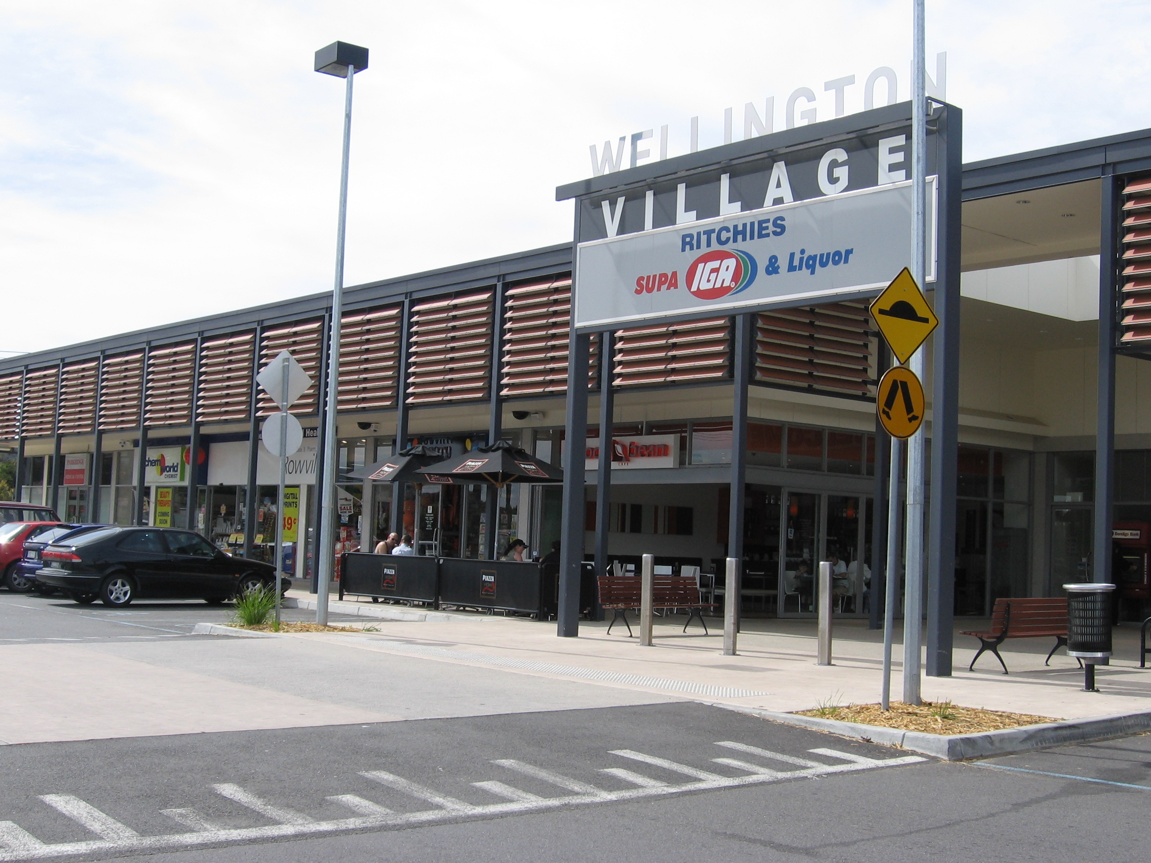
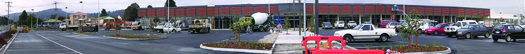
Wellington Village Shopping Centre east façade in 2004.
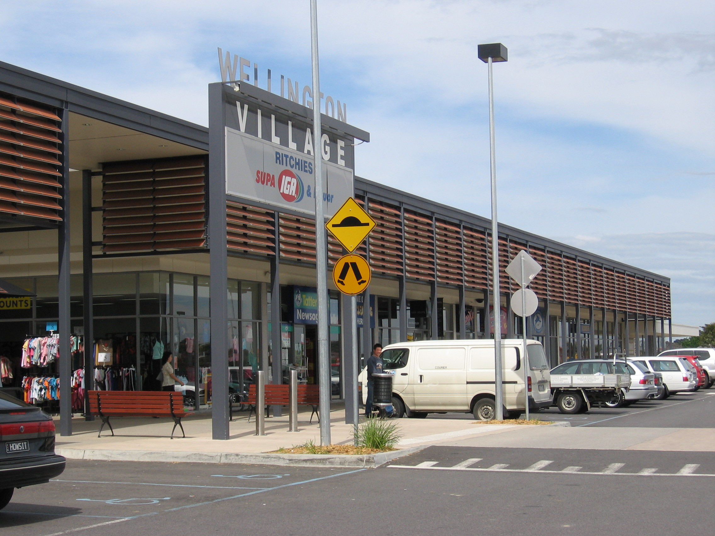
Wellington Village Shopping Centre west façade in 2004.
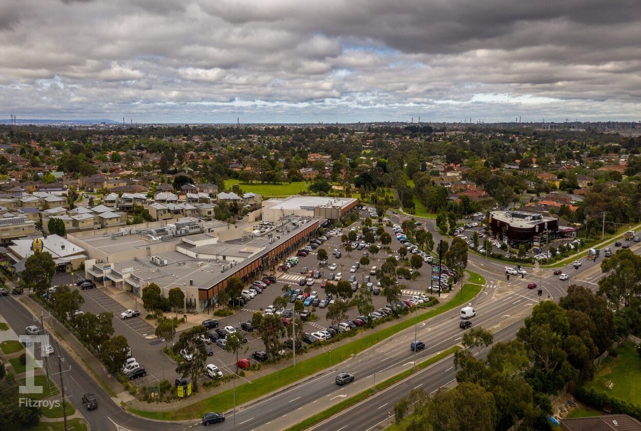
Wellington Village Shopping Centre aerial image present day.
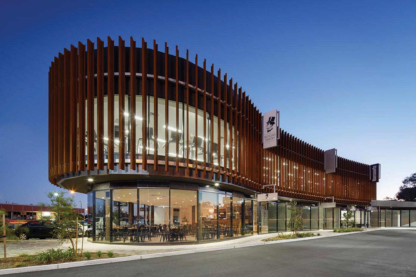
2015 The Corner – completed.
From Coy+Yiontis Architects
WELLINGTON VILLAGE: Completed 2004
The client’s brief was to create a commercial centre that would act as a community focus. To this end a number of civic elements (the collonade and piazza) were incorporated to encourage the public to inhabit the centre. Energy efficiency is also a concern for this client. The design incorporates numerous strategies to reduce energy consumption of the complex.
THE CORNER: Completed 2015
Like its predecessors, this building uses screens to define its façade. The form of the building has evolved however. Referred to in-house as ‘the Blob’, the floor plan is organic and a striking contrast to its older neighbours. The vertical blades of CORTEN steel have been allowed to rust over time and effectively screen the upper floors, at the same time creating a striking visual landmark visible from the freeway.